Area Overview for BB9 0HR
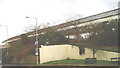
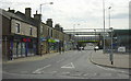
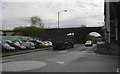
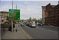
Photos of BB9 0HR
Area Information
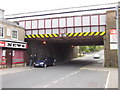
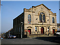
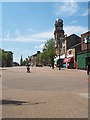
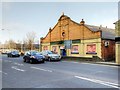
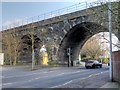
Living in BB9 0HR means being part of a small, tightly knit residential cluster in the town of Nelson, Lancashire. With a population of 1,722, this postcode area reflects the broader character of Nelson, a town shaped by 19th-century industrial growth and historic infrastructure like the Leeds-Liverpool Canal and East Lancashire Railway. The area is defined by its compact size and proximity to key amenities, including five nearby railway stations such as Nelson and Colne, which connect residents to surrounding towns. Daily life here is influenced by the town’s heritage, with 19th-century commercial streets and a mix of older homes. The median age of 47 suggests a community of established residents, many of whom are in their prime working years. BB9 0HR is not a sprawling suburb but a focused, manageable area where proximity to services and transport links plays a central role in quality of life.
- Area Type
- Postcode
- Area Size
- Not available
- Population
- 1722
- Population Density
- 2144 people/km²
The property market in BB9 0HR is characterised by high home ownership (80%) and a focus on houses rather than flats or apartments. This suggests a market skewed towards owner-occupied homes, with limited rental activity. The predominance of houses indicates a preference for single-family dwellings, which may appeal to families or those seeking more space. Given the small size of the area, the housing stock is likely limited, making it a niche market for buyers prioritising proximity to Nelson’s amenities. The surrounding area, including nearby railway stations, could offer additional options for those seeking larger properties or alternative locations. For buyers, this means a competitive market with a focus on established homes rather than new developments.
House Prices in BB9 0HR
No properties found in this postcode.
Energy Efficiency in BB9 0HR
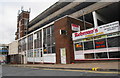
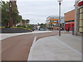
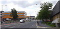
Life in BB9 0HR is shaped by its proximity to practical amenities, including five retail spots such as Spar Netherfield and Lidl Central, which provide everyday shopping convenience. The area’s railway stations, like Nelson and Colne, offer easy access to nearby towns, enhancing connectivity for both leisure and work. While the data does not specify parks or leisure facilities, the town’s historic core—centred on Manchester Road and Market Street—suggests a mix of 19th-century shops and commercial spaces. The presence of retail options and rail links means residents can enjoy local convenience without needing to travel far. The compact nature of the area ensures that essential services are within walking or short driving distance, supporting a lifestyle that balances accessibility with a sense of community.
Amenities
Schools
| Rank | School | Type | Entry gender | Ages |
|---|
Explore more schools in this area
Go to Schools tabDemographics
The community in BB9 0HR is predominantly composed of adults aged 30–64, with a median age of 47. This suggests a mature, stable population, likely with strong ties to local employment and long-term residency. Home ownership is high at 80%, indicating a preference for private residence over renting, which is uncommon in this area. The accommodation type is primarily houses, reflecting a lack of high-density housing and a focus on family-oriented living. The predominant ethnic group is White, though specific data on diversity or deprivation is not provided. The age profile and ownership figures imply a community with established households, potentially with children in local schools. With a population of 1,722, the area is small enough to foster familiarity but large enough to support essential services.
Household Size
Accommodation Type
Tenure
Ethnic Group
Religion
Household Composition
Age
Household Deprivation
NS-SEC
Explore more demographic insights in this area
Go to Demographics tabPlanning
Planning Constraints
- Flood RiskPremium
- Ramsar Wetland SitesPremium
- Area of Outstanding Natural BeautyPremium
- Protected Nature ReservePremium
- Protected WoodlandPremium