Area Overview for BB9 0AT
Photos of BB9 0AT
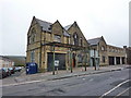
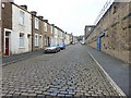
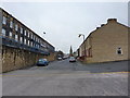
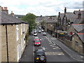
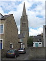
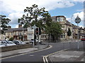
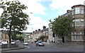
100 photos from this area
Area Information
Key information about the BB9 0AT including its size, population, and administrative classification.
- Area Type
- Postcode
- Area Size
- 1.9 hectares
- Population
- 1825
- Population Density
- 4100 people/km²
House Prices in BB9 0AT
51
Properties
£108,120
Average Sold Price
£30,000
Lowest Price
£240,000
Highest Price
Showing 51 properties
| Address | Type | Beds | Baths | Last Sale Price | Last Sale Date | |
|---|---|---|---|---|---|---|
| 44 Queensgate, Nelson, BB9 0AT | Detached | 3 | 1 | £187,000 | Dec 2025 | |
| 19 Queensgate, Nelson, BB9 0AT | Bungalow | 2 | 1 | £135,000 | Mar 2025 | |
| 46 Queensgate, Nelson, BB9 0AT | house | 3 | 1 | £175,000 | Jan 2024 | |
| 34 Queensgate, Nelson, BB9 0AT | house | 5 | - | £240,000 | Nov 2023 | |
| 20 Queensgate, Nelson, BB9 0AT | Bungalow | - | - | £135,000 | May 2022 | |
| 14 Queensgate, Nelson, BB9 0AT | Semi-detached | 3 | 1 | £159,000 | Mar 2022 | |
| 41 Queensgate, Nelson, BB9 0AT | Semi-detached | 2 | 1 | £130,000 | Sep 2020 | |
| 12 Queensgate, Nelson, BB9 0AT | Semi-detached | 3 | 1 | £125,000 | Jul 2020 | |
| 43 Queensgate, Nelson, BB9 0AT | Semi-detached | 3 | 1 | £133,000 | Apr 2020 | |
| 7 Queensgate, Nelson, BB9 0AT | house | - | - | £138,000 | Sep 2018 |
Page 1 of 6
Energy Efficiency in BB9 0AT
Amenities
Schools
| Rank | School | Type | Entry gender | Ages |
|---|
Explore more schools in this area
Go to Schools tabDemographics
Household Size
Family (3-5 people)
most common
Accommodation Type
Houses
most common
Tenure
72
majority
Ethnic Group
asian_total
most common
Religion
N/A
most common
Household Composition
N/A
most common
Age
47
median
Adults (30-64 years)
most common
Household Deprivation
N/A
with no deprivation
NS-SEC
22
in Lower managerial occupations
Explore more demographic insights in this area
Go to Demographics tabPlanning
Planning Constraints
- Flood RiskPremium
- Ramsar Wetland SitesPremium
- Area of Outstanding Natural BeautyPremium
- Protected Nature ReservePremium
- Protected WoodlandPremium