Area Overview for BB8 8PD
Photos of BB8 8PD
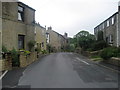
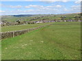
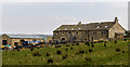

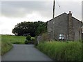
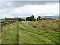
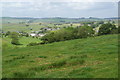
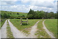
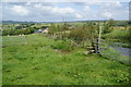
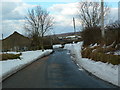
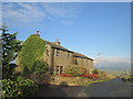
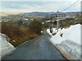
15 photos from this area
Area Information
Key information about the BB8 8PD including its size, population, and administrative classification.
- Area Type
- Postcode
- Area Size
- 8.1 hectares
- Population
- 1854
- Population Density
- 76 people/km²
House Prices in BB8 8PD
11
Properties
£112,000
Average Sold Price
£43,000
Lowest Price
£175,000
Highest Price
Showing 11 properties
| Address | Type | Beds | Baths | Last Sale Price | Last Sale Date | |
|---|---|---|---|---|---|---|
| 5 Bright Terrace, Trawden, BB8 8PD | house | 2 | - | £123,000 | Apr 2020 | |
| Moorland Cottage, Bright Terrace, Trawden, BB8 8PD | Semi-detached | - | - | £175,000 | Nov 2016 | |
| 3 Bright Terrace, Trawden, BB8 8PD | Terraced | 2 | 1 | £107,000 | May 2005 | |
| 1 Bright Terrace, Trawden, BB8 8PD | Terraced | - | - | £43,000 | Mar 1997 | |
| 9 Bright Terrace, Trawden, BB8 8PD | Terraced | 2 | 1 | - | - | |
| Green Meadow, Bright Terrace, Trawden, BB8 8PD | Detached | - | - | - | - | |
| Long Green, Bright Terrace, Trawden, BB8 8PD | house | - | - | - | - | |
| The Fells, Bright Terrace, Trawden, BB8 8PD | Detached | - | - | - | - | |
| Oak Cottage, Bright Terrace, Trawden, BB8 8PD | Semi-detached | - | - | - | - | |
| 7 Bright Terrace, Trawden, BB8 8PD | Terraced | - | - | - | - |
Page 1 of 2
Energy Efficiency in BB8 8PD
Amenities
Schools
| Rank | School | Type | Entry gender | Ages |
|---|
Explore more schools in this area
Go to Schools tabDemographics
Household Size
Two person
most common
Accommodation Type
Houses
most common
Tenure
84
majority
Ethnic Group
White
most common
Religion
N/A
most common
Household Composition
N/A
most common
Age
47
median
Adults (30-64 years)
most common
Household Deprivation
N/A
with no deprivation
NS-SEC
38
in Lower managerial occupations
Explore more demographic insights in this area
Go to Demographics tabPlanning
Planning Constraints
- Flood RiskPremium
- Ramsar Wetland SitesPremium
- Area of Outstanding Natural BeautyPremium
- Protected Nature ReservePremium
- Protected WoodlandPremium