Area Overview for BB8 7EJ
Photos of BB8 7EJ
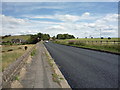
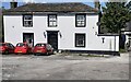
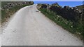
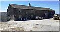
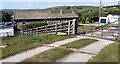
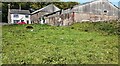
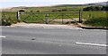
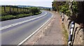
27 photos from this area
Area Information
Key information about the BB8 7EJ including its size, population, and administrative classification.
- Area Type
- Postcode
- Area Size
- 3.6 km²
- Population
- 1850
- Population Density
- 103 people/km²
House Prices in BB8 7EJ
16
Properties
£261,625
Average Sold Price
£69,500
Lowest Price
£479,500
Highest Price
Showing 16 properties
| Address | Type | Beds | Baths | Last Sale Price | Last Sale Date | |
|---|---|---|---|---|---|---|
| Heather Royd, Keighley Road, Colne, BB8 7EJ | house | - | - | £232,500 | Mar 2010 | |
| 1, Emmott Barn, Keighley Road, Laneshawbridge, BB8 7EJ | house | - | - | £265,000 | Dec 2009 | |
| Earl Hall Farm, Keighley Road, Colne, BB8 7EJ | house | - | - | £479,500 | Sep 2006 | |
| Lyndene, Keighley Road, Colne, BB8 7EJ | Semi-detached | - | - | £69,500 | Jan 2000 | |
| Reservoir House, Keighley Road, Cowling, BB8 7EJ | Detached | - | - | - | - | |
| The Keepers House, Laneshawbridge Reservoir, Keighley Road, Laneshawbridge, Colne, BB8 7EJ | Detached | - | - | - | - | |
| Hargreaves Arms, Keighley Road, Laneshawbridge, BB8 7EJ | Detached | - | - | - | - | |
| Monkroyd Farm, Keighley Road, Laneshawbridge, BB8 7EJ | Detached | - | - | - | - | |
| Monkroyd Bungalow, Keighley Road, Laneshawbridge, BB8 7EJ | Detached | - | - | - | - | |
| Cornclose Farm, Keighley Road, Laneshawbridge, BB8 7EJ | Detached | - | - | - | - |
Page 1 of 2
Energy Efficiency in BB8 7EJ
Amenities
Schools
| Rank | School | Type | Entry gender | Ages |
|---|
Explore more schools in this area
Go to Schools tabDemographics
Household Size
Two person
most common
Accommodation Type
Houses
most common
Tenure
78
majority
Ethnic Group
White
most common
Religion
N/A
most common
Household Composition
N/A
most common
Age
47
median
Adults (30-64 years)
most common
Household Deprivation
N/A
with no deprivation
NS-SEC
41
in Lower managerial occupations
Explore more demographic insights in this area
Go to Demographics tabPlanning
Planning Constraints
- Flood RiskPremium
- Ramsar Wetland SitesPremium
- Area of Outstanding Natural BeautyPremium
- Protected Nature ReservePremium
- Protected WoodlandPremium