Area Overview for BB8 0HT
Photos of BB8 0HT


Area Information
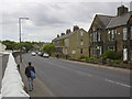
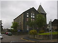
BB8 0HT is a small residential postcode area nestled within the historic market town of Colne, Lancashire. With a population of 1968, it reflects the character of a close-knit community, where the landscape is shaped by centuries of agricultural and industrial heritage. The area’s compact size means residents are likely to know their neighbours, with daily life centred around local amenities and historical landmarks. Colne itself, with its origins tracing back to the Stone Age, offers a blend of rural tranquillity and accessible town facilities. The postcode area benefits from proximity to retail hubs like Tesco Colne and rail connections to Colne, Nelson, and Brierfield stations, ensuring practical links to nearby towns. Digital connectivity is robust, with a broadband score of 94, ideal for remote work or streaming. However, the area’s crime risk is notably high, requiring residents to remain vigilant. For those seeking a balance between tradition and modern convenience, BB8 0HT presents a distinctive mix of historical depth and contemporary living.
- Area Type
- Postcode
- Area Size
- Not available
- Population
- 1968
- Population Density
- 3217 people/km²
The property market in BB8 0HT is defined by a 41% home ownership rate, indicating that less than half of properties are owner-occupied. This suggests a significant rental market, with many residents likely renting from private landlords or housing associations. The area’s accommodation type is predominantly houses, which are more common than flats or apartments. Given the small size of the postcode area, the housing stock is limited, potentially making the market competitive for buyers. The presence of houses may appeal to those seeking larger living spaces, though the lack of detailed data on property types or price ranges means buyers must consider the broader Colne area for options. The balance between rental availability and owner-occupied properties could influence both affordability and long-term investment potential.
House Prices in BB8 0HT
No properties found in this postcode.
Energy Efficiency in BB8 0HT
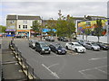
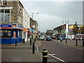
The lifestyle in BB8 0HT is shaped by its proximity to retail and transport hubs. Within practical reach are five retail outlets, including Tesco Colne, Farmfoods Colne, and Aldi Colne, offering a range of shopping options. The rail network, with stations at Colne, Nelson, and Brierfield, provides access to nearby towns and cultural amenities. While the area’s small size means limited parks or leisure facilities, its historical roots in Colne offer access to heritage sites like St Bartholomew’s Church and the Cloth Hall. The community’s character is influenced by its past as a market town, with a blend of traditional and modern conveniences. The combination of retail accessibility, rail links, and historical landmarks contributes to a lifestyle that balances practicality with local heritage.
Amenities
Schools
Residents of BB8 0HT have access to two key educational institutions within practical reach. Newtown Nursery School provides early years education, while West Street Community Primary School offers primary education with a good Ofsted rating. The presence of a primary school with a strong rating is a significant advantage for families, though secondary education options are not listed in the data. The mix of nursery and primary schools suggests a focus on early education, which may require families to travel further for secondary schooling. This could be a consideration for parents prioritising a full range of educational facilities. The quality of the primary school, however, adds value to the area for households with young children.
| Rank | School | Type | Entry gender | Ages |
|---|
Explore more schools in this area
Go to Schools tabDemographics
The population of BB8 0HT is predominantly adults aged 30–64, with a median age of 47, reflecting a mature community. Home ownership stands at 41%, suggesting a mix of owner-occupied properties and rental stock. The area is characterised by houses rather than flats, aligning with a more traditional housing stock. The predominant ethnic group is White, with no specific data on other demographics provided. This age profile indicates a stable population, likely comprising professionals, families, and retirees. The relatively low home ownership rate may suggest a higher proportion of renters, which could influence the local property market dynamics. The absence of detailed diversity statistics means the community’s composition remains largely defined by its historical and socioeconomic context.
Household Size
Accommodation Type
Tenure
Ethnic Group
Religion
Household Composition
Age
Household Deprivation
NS-SEC
Explore more demographic insights in this area
Go to Demographics tabPlanning
Planning Constraints
- Flood RiskPremium
- Ramsar Wetland SitesPremium
- Area of Outstanding Natural BeautyPremium
- Protected Nature ReservePremium
- Protected WoodlandPremium