Area Overview for BB8 0EL
Photos of BB8 0EL

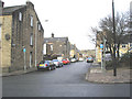

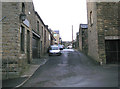
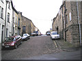
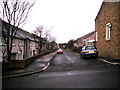

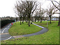
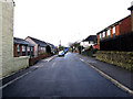

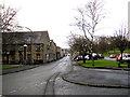
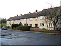
100 photos from this area
Area Information
Key information about the BB8 0EL including its size, population, and administrative classification.
- Area Type
- Postcode
- Area Size
- 6179 m²
- Population
- 1968
- Population Density
- 318512 people/km²
House Prices in BB8 0EL
35
Properties
£39,788
Average Sold Price
£11,000
Lowest Price
£66,250
Highest Price
Showing 35 properties
| Address | Type | Beds | Baths | Last Sale Price | Last Sale Date | |
|---|---|---|---|---|---|---|
| 25 Walton Street, Colne, BB8 0EL | Terraced | 2 | 1 | £54,500 | Aug 2025 | |
| 29 Walton Street, Colne, BB8 0EL | Terraced | 2 | 1 | £66,250 | Oct 2024 | |
| 35 Walton Street, Colne, BB8 0EL | Terraced | 2 | 1 | £59,999 | Sep 2019 | |
| 62 Walton Street, Colne, BB8 0EL | house | - | - | £18,000 | Nov 2011 | |
| 82 Walton Street, Colne, BB8 0EL | house | - | - | £46,000 | Nov 2010 | |
| 68 Walton Street, Colne, BB8 0EL | house | - | - | £43,000 | Aug 2010 | |
| 78 Walton Street, Colne, BB8 0EL | house | - | - | £40,000 | Aug 2010 | |
| 66 Walton Street, Colne, BB8 0EL | house | - | - | £45,000 | May 2010 | |
| 56 Walton Street, Colne, BB8 0EL | house | - | - | £35,000 | May 2010 | |
| 76 Walton Street, Colne, BB8 0EL | house | - | - | £37,500 | May 2010 |
Page 1 of 4
Energy Efficiency in BB8 0EL
Amenities
Schools
| Rank | School | Type | Entry gender | Ages |
|---|
Explore more schools in this area
Go to Schools tabDemographics
Household Size
One person
most common
Accommodation Type
Houses
most common
Tenure
41
majority
Ethnic Group
White
most common
Religion
N/A
most common
Household Composition
N/A
most common
Age
47
median
Adults (30-64 years)
most common
Household Deprivation
N/A
with no deprivation
NS-SEC
17
in Lower managerial occupations
Explore more demographic insights in this area
Go to Demographics tabPlanning
Planning Constraints
- Flood RiskPremium
- Ramsar Wetland SitesPremium
- Area of Outstanding Natural BeautyPremium
- Protected Nature ReservePremium
- Protected WoodlandPremium