Area Overview for BB7 9WB
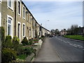
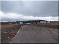
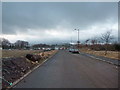
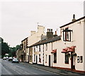
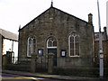
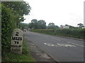
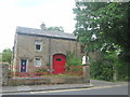
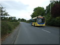
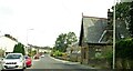
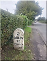
Photos of BB7 9WB


Area Information
Living in BB7 9WB offers a quiet, compact residential experience in a small cluster of homes spread across England. With a population of 2,246 and a low density of 93 people per square kilometre, the area feels uncluttered and community-focused. This is a place where daily life revolves around local amenities and a stable, mature demographic. The postcode’s proximity to railway stations like Whalley and Clitheroe ensures easy access to nearby towns, while the presence of Barrow URC Primary School with a good Ofsted rating makes it appealing for families. BB7 9WB is not a sprawling suburb but a tight-knit cluster where residents are likely to know their neighbours. Its small size means the area is manageable for those who prefer a slower pace of life, though it remains connected to broader networks through rail links and digital infrastructure. The low flood risk and below-average crime rate further contribute to a sense of security, making it a practical choice for those prioritising safety and simplicity.
- Area Type
- Postcode
- Area Size
- Not available
- Population
- 2246
- Population Density
- 93 people/km²
BB7 9WB is a predominantly owner-occupied area, with 82% of residents living in homes they own. The accommodation type is primarily houses, which is unusual for a small postcode area but suggests a mix of larger properties and possibly semi-detached or detached homes. This contrasts with areas dominated by rental properties or flats, making BB7 9WB more attractive to buyers seeking long-term stability. The low population density of 93 people per square kilometre implies that homes are spaced apart, offering privacy and potentially larger outdoor spaces. For buyers, this means a market where properties are likely to be in good condition, given the age of the population and the emphasis on home ownership. However, the small size of the area means the housing stock is limited, and buyers may need to consider nearby postcodes for more options.
House Prices in BB7 9WB
No properties found in this postcode.
Energy Efficiency in BB7 9WB
Residents of BB7 9WB have access to five retail outlets within practical reach, including Asda Barrow, Spar, and Co-op King. These shops provide essentials and convenience, supporting daily needs without requiring long trips. The rail network, with stations at Whalley, Clitheroe, and Langho, connects the area to broader regional services and employment opportunities. While the data does not mention parks or leisure facilities, the low population density and absence of planning constraints suggest open spaces may be available nearby. The combination of retail options and rail links creates a lifestyle that balances local convenience with regional connectivity, ideal for those who value accessibility without urban congestion.
Amenities
Schools
The nearest school to BB7 9WB is Barrow URC Primary School, which serves the local community with a good Ofsted rating. This school is the only primary institution listed in the data, indicating that families in the area rely on it for early education. The absence of secondary schools within the postcode means students may need to travel to nearby towns for higher education, though rail links to Whalley and Clitheroe could facilitate this. The presence of a well-rated primary school is a significant draw for families, as it suggests a commitment to local education and potentially a supportive school environment. However, the lack of nearby secondary schools may be a consideration for parents planning long-term in the area.
| Rank | School | Type | Entry gender | Ages |
|---|
Explore more schools in this area
Go to Schools tabDemographics
The community in BB7 9WB is predominantly composed of adults aged 30-64, with a median age of 47. This suggests a mature population, likely settled in long-term homes rather than transient rentals. Home ownership is high at 82%, indicating a stable housing market where most residents are homeowners. The area is characterised by houses rather than flats, aligning with the preference of older generations for traditional property types. The predominant ethnic group is White, reflecting a homogenous demographic profile. While no specific data on deprivation is provided, the high home ownership rate and low crime score of 72 suggest a relatively affluent and secure environment. This demographic structure implies a community with established routines, where local amenities and schools are likely to cater to the needs of families and older residents.
Household Size
Accommodation Type
Tenure
Ethnic Group
Religion
Household Composition
Age
Household Deprivation
NS-SEC
Explore more demographic insights in this area
Go to Demographics tabPlanning
Planning Constraints
- Flood RiskPremium
- Ramsar Wetland SitesPremium
- Area of Outstanding Natural BeautyPremium
- Protected Nature ReservePremium
- Protected WoodlandPremium