Area Overview for BB7 9DT
Photos of BB7 9DT
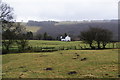
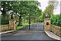
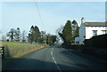
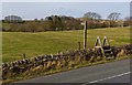
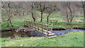
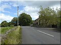
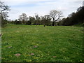
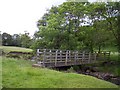
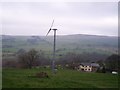
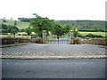

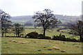
15 photos from this area
Area Information
Key information about the BB7 9DT including its size, population, and administrative classification.
- Area Type
- Postcode
- Area Size
- 1.5 km²
- Population
- 1583
- Population Density
- 160 people/km²
House Prices in BB7 9DT
22
Properties
£704,667
Average Sold Price
£177,500
Lowest Price
£1,970,500
Highest Price
Showing 22 properties
| Address | Type | Beds | Baths | Last Sale Price | Last Sale Date | |
|---|---|---|---|---|---|---|
| Higher Greenbank Barn, Whalley Road, Sabden, BB7 9DT | Semi-detached | 4 | 3 | £585,000 | Jul 2023 | |
| Lower Greenbank Barn, Whalley Road, Sabden, BB7 9DT | house | - | - | £580,000 | Jun 2021 | |
| Lower Barn Farm, Whalley Road, Sabden, BB7 9DT | Detached | 5 | - | £1,970,500 | Sep 2016 | |
| Dove Cottage, Whalley Road, Sabden, BB7 9DT | Detached | 3 | 1 | £265,000 | Jun 2016 | |
| Greenbank Farm, Whalley Road, Sabden, BB7 9DT | house | - | - | £650,000 | Apr 2013 | |
| Swallow Cottage, Whalley Road, Sabden, BB7 9DT | Detached | - | - | £177,500 | Nov 2010 | |
| Laneside Farm, Whalley Road, Sabden, BB7 9DT | Detached | 5 | 2 | - | - | |
| Swallow Barn, Whalley Road, Sabden, BB7 9DT | house | - | - | - | - | |
| Chalet At Dove Cottage, Dove Cottage, Whalley Road, Sabden, BB7 9DT | Mobile Home | - | - | - | - | |
| Poultry Farm, Whalley Road, Sabden, BB7 9DT | Farm | - | - | - | - |
Page 1 of 3
Energy Efficiency in BB7 9DT
Amenities
Schools
| Rank | School | Type | Entry gender | Ages |
|---|
Explore more schools in this area
Go to Schools tabDemographics
Household Size
Two person
most common
Accommodation Type
Houses
most common
Tenure
75
majority
Ethnic Group
White
most common
Religion
N/A
most common
Household Composition
N/A
most common
Age
47
median
Adults (30-64 years)
most common
Household Deprivation
N/A
with no deprivation
NS-SEC
39
in Lower managerial occupations
Explore more demographic insights in this area
Go to Demographics tabPlanning
Planning Constraints
- Flood RiskPremium
- Ramsar Wetland SitesPremium
- Area of Outstanding Natural BeautyPremium
- Protected Nature ReservePremium