Area Overview for BB7 4EX
Photos of BB7 4EX
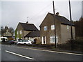
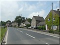
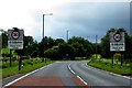
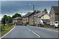
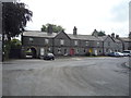
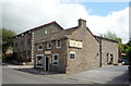
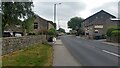
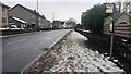
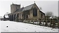
21 photos from this area
Area Information
Key information about the BB7 4EX including its size, population, and administrative classification.
- Area Type
- Postcode
- Area Size
- 13.0 hectares
- Population
- 1439
- Population Density
- 22 people/km²
House Prices in BB7 4EX
20
Properties
£235,625
Average Sold Price
£80,000
Lowest Price
£455,000
Highest Price
Showing 20 properties
| Address | Type | Beds | Baths | Last Sale Price | Last Sale Date | |
|---|---|---|---|---|---|---|
| Oaklands Cottage, Bentlea Road, Gisburn, BB7 4EX | Semi-detached | 2 | 1 | £170,000 | Apr 2025 | |
| Creag Mhor, Bentlea Road, Gisburn, BB7 4EX | Bungalow | - | - | £325,000 | Apr 2022 | |
| Stonecroft, Bentlea Road, Gisburn, BB7 4EX | Bungalow | 2 | 1 | £287,000 | May 2021 | |
| Avondale, Bentlea Road, Gisburn, BB7 4EX | Bungalow | - | - | £180,000 | Jul 2011 | |
| Sunnyview Cottage, Bentlea Road, Gisburn, BB7 4EX | Detached | - | - | £455,000 | Jun 2008 | |
| Westcroft, Bentlea Road, Gisburn, BB7 4EX | Bungalow | - | - | £198,000 | Dec 2003 | |
| Soay, Bentlea Road, Gisburn, BB7 4EX | Detached | 4 | 2 | £190,000 | Aug 2002 | |
| Springfields, Bentlea Road, Gisburn, BB7 4EX | Detached | - | - | £80,000 | Mar 1998 | |
| Alderwood, Bentlea Road, Gisburn, BB7 4EX | Bungalow | 2 | - | - | - | |
| Levanto, Bentlea Road, Gisburn, BB7 4EX | Detached | - | - | - | - |
Page 1 of 2
Energy Efficiency in BB7 4EX
Amenities
Schools
| Rank | School | Type | Entry gender | Ages |
|---|
Explore more schools in this area
Go to Schools tabDemographics
Household Size
Two person
most common
Accommodation Type
Houses
most common
Tenure
77
majority
Ethnic Group
White
most common
Religion
N/A
most common
Household Composition
N/A
most common
Age
47
median
Adults (30-64 years)
most common
Household Deprivation
N/A
with no deprivation
NS-SEC
43
in Lower managerial occupations
Explore more demographic insights in this area
Go to Demographics tabPlanning
Planning Constraints
- Flood RiskPremium
- Ramsar Wetland SitesPremium
- Area of Outstanding Natural BeautyPremium
- Protected Nature ReservePremium
- Protected WoodlandPremium