Area Overview for BB6 8FA
Photos of BB6 8FA
Area Information
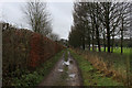
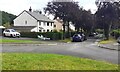
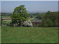
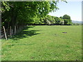
Living in BB6 8FA means being part of a small, rural residential cluster in the Ribble Valley district of Lancashire. The area covers just 3.4 hectares and is home to 2,052 people, creating a tight-knit community feel. Historically, Billington and Langho were defined by rural lands along the River Calder, with a legacy of cotton-weaving and Saxon settlements. Today, the area retains its quiet, rural character, with a population skewed towards adults aged 30–64. The village is served by St Augustine’s Roman Catholic High School and nearby rail stations, offering practical connectivity without the noise of urban life. Residents benefit from low crime rates and minimal environmental constraints, such as no protected nature reserves or flood risks. The area’s charm lies in its simplicity: a blend of historic chapels, ancient woods, and a relaxed pace of life, ideal for those seeking a peaceful, low-maintenance existence in a landscape steeped in history.
- Area Type
- Postcode
- Area Size
- 3.4 hectares
- Population
- 2052
- Population Density
- 289 people/km²
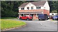
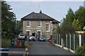
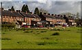
The property market in BB6 8FA is characterised by high home ownership (85%) and a focus on houses rather than flats or shared accommodation. This suggests a market primarily driven by owner-occupiers, likely families or retirees seeking a rural retreat. The small area size—just 3.4 hectares—means housing stock is limited, with few new developments. The predominance of houses indicates a demand for spacious, private homes, which may appeal to buyers prioritising outdoor space and low density. However, the limited size of the area could restrict property choice, making it essential for buyers to consider nearby villages or towns for additional options. The market is unlikely to cater to short-term renters, reflecting a community built around long-term residency rather than transient populations.
House Prices in BB6 8FA
Showing 2 properties
| Address | Type | Beds | Baths | Last Sale Price | Last Sale Date | |
|---|---|---|---|---|---|---|
| Housekeepers Flat, The Lodge Blackburn Rovers Senior Training Centre, Gleneagles Drive, Brockhall Village, Old Langho, BB6 8FA | Flat | - | - | - | - | |
| The Lodge, Blackburn Rovers Senior Training Centre, Gleneagles Drive, Brockhall Village, Old Langho, BB6 8FA | secure_residential | - | - | - | - |
Energy Efficiency in BB6 8FA
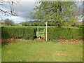
Life in BB6 8FA is defined by rural simplicity and local amenities. Residents can access five rail stations, including Langho and Whalley, providing links to nearby towns. Retail options include Spar and Co-op King, offering essentials without the need to travel far. The area’s natural assets, such as Billington Common and ancient woods like Elker and Nab, provide opportunities for walking, cycling, or leisure. The village’s historical character, with sites like the Grade I-listed Chapel of St Leonard, adds cultural depth. While the amenities are modest, they cater to daily needs, complemented by the area’s quiet, low-density environment. This lifestyle suits those who prioritise tranquillity over urban convenience, with a strong emphasis on community and connection to the landscape.
Amenities
Schools
Residents of BB6 8FA have access to two schools within the area. St Augustine’s Roman Catholic High School, Billington, is a primary school serving local families, while St Augustine’s Roman Catholic High School, a Voluntary Academy, is rated ‘good’ by Ofsted. The presence of both a primary and academy school suggests a range of educational options, though the data does not specify whether the academy caters to secondary students. This mix may support families requiring both early education and secondary schooling, though parents should verify the exact age groups served. The schools’ religious affiliation aligns with the area’s predominantly White and historically Catholic demographic, offering a familiar educational environment.
| Rank | School | Type | Entry gender | Ages |
|---|
Explore more schools in this area
Go to Schools tabDemographics
The demographic profile of BB6 8FA reflects a mature, stable population. The median age is 47, with the majority of residents falling within the 30–64 age range. Home ownership is high at 85%, indicating a community of long-term residents rather than transient renters. The accommodation type is predominantly houses, suggesting a focus on family homes and single-family living. The predominant ethnic group is White, aligning with broader trends in rural Lancashire. This demographic structure implies a community with strong local ties and a focus on stability. The absence of significant deprivation data suggests that residents generally enjoy a quality of life supported by low crime rates and access to essential services. However, the limited diversity in age and ethnicity may mean fewer social or cultural amenities compared to larger urban areas.
Household Size
Accommodation Type
Tenure
Ethnic Group
Religion
Household Composition
Age
Household Deprivation
NS-SEC
Explore more demographic insights in this area
Go to Demographics tabPlanning
Planning Constraints
- Flood RiskPremium
- Ramsar Wetland SitesPremium
- Area of Outstanding Natural BeautyPremium
- Protected Nature ReservePremium
- Protected WoodlandPremium