Area Overview for BB6 8BG
Photos of BB6 8BG
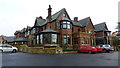
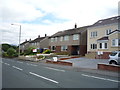
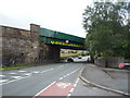
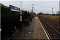
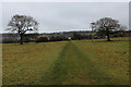
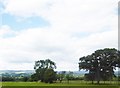

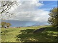
39 photos from this area
Area Information
Key information about the BB6 8BG including its size, population, and administrative classification.
- Area Type
- Postcode
- Area Size
- 5.0 hectares
- Population
- 1294
- Population Density
- 202 people/km²
House Prices in BB6 8BG
11
Properties
£401,667
Average Sold Price
£235,000
Lowest Price
£650,000
Highest Price
Showing 11 properties
| Address | Type | Beds | Baths | Last Sale Price | Last Sale Date | |
|---|---|---|---|---|---|---|
| Treetops, Northcote Road, Langho, BB6 8BG | Detached | 4 | 3 | £235,000 | Jan 2017 | |
| Peregrines, Northcote Road, Langho, BB6 8BG | Detached | 4 | 1 | £320,000 | Dec 2016 | |
| Broad Oaks, Northcote Road, Langho, BB6 8BG | Detached | - | - | £650,000 | Aug 2011 | |
| Coniston, Northcote Road, Langho, BB6 8BG | Detached | 4 | - | - | - | |
| Annexe, Lyndon, Northcote Road, Langho, BB6 8BG | Flat | - | - | - | - | |
| Hollocombe, Northcote Road, Langho, BB6 8BG | Semi-detached | - | - | - | - | |
| Warrenside, Northcote Road, Langho, BB6 8BG | house | - | - | - | - | |
| Lyndon, Northcote Road, Langho, BB6 8BG | Detached | - | - | - | - | |
| Ferns, Northcote Road, Langho, BB6 8BG | Bungalow | 4 | 1 | - | - | |
| Southwin, Northcote Road, Langho, BB6 8BG | Semi-detached | - | - | - | - |
Page 1 of 2
Energy Efficiency in BB6 8BG
Amenities
Schools
| Rank | School | Type | Entry gender | Ages |
|---|
Explore more schools in this area
Go to Schools tabDemographics
Household Size
Two person
most common
Accommodation Type
Houses
most common
Tenure
84
majority
Ethnic Group
White
most common
Religion
N/A
most common
Household Composition
N/A
most common
Age
47
median
Adults (30-64 years)
most common
Household Deprivation
N/A
with no deprivation
NS-SEC
41
in Lower managerial occupations
Explore more demographic insights in this area
Go to Demographics tabPlanning
Planning Constraints
- Flood RiskPremium
- Ramsar Wetland SitesPremium
- Area of Outstanding Natural BeautyPremium
- Protected Nature ReservePremium
- Protected WoodlandPremium