Area Overview for BB5 6XQ
Photos of BB5 6XQ
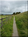
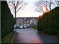
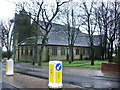
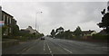
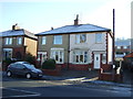
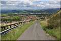
50 photos from this area
Area Information
Key information about the BB5 6XQ including its size, population, and administrative classification.
- Area Type
- Postcode
- Area Size
- 7965 m²
- Population
- 1519
- Population Density
- 1083 people/km²
House Prices in BB5 6XQ
10
Properties
£172,520
Average Sold Price
£82,000
Lowest Price
£299,950
Highest Price
Showing 10 properties
| Address | Type | Beds | Baths | Last Sale Price | Last Sale Date | |
|---|---|---|---|---|---|---|
| 14 Badgers Close, Accrington, BB5 6XQ | house | 4 | 2 | £299,950 | Aug 2022 | |
| 3 Badgers Close, Accrington, BB5 6XQ | Detached | 4 | 2 | £247,500 | Jan 2021 | |
| 4 Badgers Close, Accrington, BB5 6XQ | Detached | 4 | 1 | £210,000 | Jan 2014 | |
| 8 Badgers Close, Accrington, BB5 6XQ | Detached | - | - | £260,000 | Jul 2007 | |
| 9 Badgers Close, Accrington, BB5 6XQ | Detached | - | - | £180,000 | Sep 2003 | |
| 10 Badgers Close, Accrington, BB5 6XQ | Detached | - | - | £160,000 | Jan 2001 | |
| 7 Badgers Close, Accrington, BB5 6XQ | Detached | - | - | £82,000 | Nov 2000 | |
| 12 Badgers Close, Accrington, BB5 6XQ | Detached | - | - | £101,500 | Jun 1999 | |
| 6 Badgers Close, Accrington, BB5 6XQ | Detached | - | - | £99,750 | Dec 1998 | |
| 5 Badgers Close, Accrington, BB5 6XQ | Detached | - | - | £84,500 | Mar 1998 |
Energy Efficiency in BB5 6XQ
Amenities
Schools
| Rank | School | Type | Entry gender | Ages |
|---|
Explore more schools in this area
Go to Schools tabDemographics
Household Size
Two person
most common
Accommodation Type
Houses
most common
Tenure
85
majority
Ethnic Group
White
most common
Religion
N/A
most common
Household Composition
N/A
most common
Age
47
median
Adults (30-64 years)
most common
Household Deprivation
N/A
with no deprivation
NS-SEC
35
in Lower managerial occupations
Explore more demographic insights in this area
Go to Demographics tabPlanning
Planning Constraints
- Flood RiskPremium
- Ramsar Wetland SitesPremium
- Area of Outstanding Natural BeautyPremium
- Protected Nature ReservePremium
- Protected WoodlandPremium