Area Overview for BB5 5YY
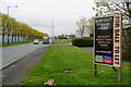
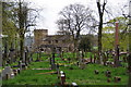
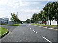
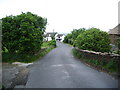
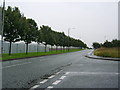
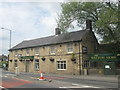
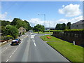
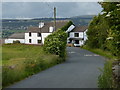
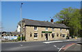
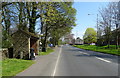
Photos of BB5 5YY


Area Information
Living in BB5 5YY means being part of a small, tightly knit residential cluster in the heart of Lancashire. With a population of 2,249 and a density of 383 people per square kilometre, this area balances compact living with a sense of community. Situated near the Henburn river and Leeds and Liverpool canal, it retains historical ties to its ecclesiastical past, including St James Church, rebuilt in 1859. The area is within easy reach of Huncoat and Accrington railway stations, offering connections to nearby towns. Daily life here is shaped by proximity to local amenities, including primary schools and retail outlets, while the surrounding landscape offers quiet, low-density living. The median age of 47 suggests a mature population, with many residents likely to be long-term residents or families seeking stability. BB5 5YY’s blend of historical character and practical modernity makes it an appealing choice for those prioritising safety, community, and ease of access to services.
- Area Type
- Postcode
- Area Size
- Not available
- Population
- 2249
- Population Density
- 383 people/km²
The property market in BB5 5YY is characterised by high home ownership (84%) and a focus on houses rather than flats or apartments. This suggests a market skewed towards owner-occupied homes, likely attracting families or individuals seeking long-term stability. The prevalence of houses implies a more spacious, traditional housing stock, which may appeal to buyers prioritising private outdoor space. Given the area’s small size and low population density, the market is likely limited in scale, with properties concentrated around key amenities like schools and rail stations. Buyers should consider that the area’s compact nature means competition for homes may be fierce, particularly near sought-after features like proximity to Huncoat Railway Station or the Leeds and Liverpool canal. For investors, the high home ownership rate indicates a resilient market, though rental opportunities may be scarce.
House Prices in BB5 5YY
No properties found in this postcode.
Energy Efficiency in BB5 5YY
Life in BB5 5YY is shaped by its proximity to practical amenities and historical sites. Within reach are retail outlets like Lidl Padiham and Tesco Padiham, offering grocery and daily shopping options. The area’s rail connections, including Huncoat and Accrington stations, provide access to broader networks. Historically, the parish includes St James Church, a listed building with ties to the 19th century, and Moorside House, linked to suffragette Lydia Becker. These landmarks add cultural depth to daily life. The surrounding landscape, with the Henburn river and Leeds and Liverpool canal, may offer recreational opportunities for residents. While the area lacks large-scale leisure facilities, its compact size ensures amenities are within walking or short driving distance, fostering a convenient, community-focused lifestyle.
Amenities
Schools
The nearest school to BB5 5YY is Altham St James Church of England Primary School, which serves the local community with a good Ofsted rating. This school provides education for younger children, though no secondary schools are listed in the data. The presence of a primary school with a strong rating is a key draw for families with young children, offering a reliable foundation for early education. However, families requiring secondary schooling may need to look beyond the immediate area, potentially increasing commuting times. The single school listed reflects the area’s small size and focus on primary education, which aligns with the demographic profile of a mature population. For those prioritising local schooling, this primary school is a significant asset, though additional research would be needed to assess broader educational options.
| Rank | School | Type | Entry gender | Ages |
|---|
Explore more schools in this area
Go to Schools tabDemographics
The community in BB5 5YY is predominantly composed of adults aged 30–64, with a median age of 47. This suggests a mature population, likely including families and professionals settled in the area. Home ownership is high at 84%, indicating a strong presence of owner-occupied properties, which often correlates with long-term residency. The accommodation type is primarily houses, reflecting a more traditional, family-friendly housing stock. The predominant ethnic group is White, though specific data on diversity or deprivation is not provided. The age profile and high home ownership suggest a stable, low-turnover community. For quality of life, this demographic may prioritise established infrastructure, such as the nearby Altham St James Church of England Primary School, and proximity to rail links. The absence of detailed diversity metrics means broader social dynamics remain unexplored in the data.
Household Size
Accommodation Type
Tenure
Ethnic Group
Religion
Household Composition
Age
Household Deprivation
NS-SEC
Explore more demographic insights in this area
Go to Demographics tabPlanning
Planning Constraints
- Flood RiskPremium
- Ramsar Wetland SitesPremium
- Area of Outstanding Natural BeautyPremium
- Protected Nature ReservePremium
- Protected WoodlandPremium