Area Overview for BB5 5YX
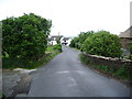
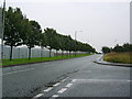
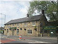
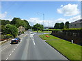
Photos of BB5 5YX
Area Information
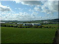
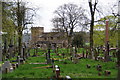
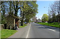
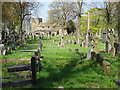
BB5 5YX is a small residential postcode area in the Hyndburn district of Lancashire, nestled near the Henburn river and the Leeds and Liverpool canal. With a population of 2249 people and a density of 383 per square kilometre, it reflects a compact, tightly knit community. The area’s historical roots are evident in its proximity to Altham, a civil parish with ties to the 18th-century ecclesiastical parish and the rebuilt St James Church, which served Accrington until 1870. Residents live within easy reach of Huncoat and Accrington railway stations, offering connections to nearby towns like Burnley and Manchester. The area’s character is shaped by its rural setting, with access to natural features like the canal, though development remains limited to residential clusters. Daily life here balances quiet living with practical access to retail and transport hubs, including Spar, Lidl Padiham, and Tesco Padiham. The demographic profile—predominantly adults aged 30–64, with high home ownership—suggests a stable, family-oriented environment.
- Area Type
- Postcode
- Area Size
- Not available
- Population
- 2249
- Population Density
- 383 people/km²
The property market in BB5 5YX is characterised by high home ownership—84% of residents own their homes—suggesting a strong preference for long-term residency over rental living. The area’s accommodation type is predominantly houses, which aligns with the demographic profile of middle-aged adults and families. This contrasts with areas where flats or apartments dominate, indicating a more traditional, suburban housing stock. The small postcode area means the housing market is limited in scale, with properties likely to be closely spaced and reflecting the local character. For buyers, this suggests a focus on established homes rather than new developments, with potential for family-oriented properties. However, the limited size of the area may mean that buyers need to consider nearby towns like Accrington or Burnley for more extensive options. The high ownership rate also implies a stable market with fewer rental properties available.
House Prices in BB5 5YX
No properties found in this postcode.
Energy Efficiency in BB5 5YX
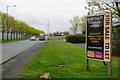
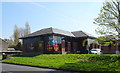
Living in BB5 5YX offers access to a mix of retail and transport amenities within practical reach. Nearby shops include Spar, Lidl Padiham, and Tesco Padiham, providing everyday convenience for groceries and household essentials. The area’s proximity to Huncoat and Accrington railway stations connects residents to broader regional networks, supporting both commuting and leisure travel. Historically, the area is linked to St James Church and Moorside House, a 19th-century residence tied to the suffragette Lydia Becker. While the data does not mention parks or leisure facilities explicitly, the presence of the Leeds and Liverpool canal suggests opportunities for outdoor activities. The lifestyle here balances rural tranquillity with accessible services, making it suitable for those seeking a quieter, community-focused environment without sacrificing practicality.
Amenities
Schools
The nearest school to BB5 5YX is Altham St James Church of England Primary School, which serves the area’s primary education needs. The school has an Ofsted rating of “good,” indicating a satisfactory standard of teaching and facilities. As a primary school, it caters to children aged 4–11, though the absence of secondary schools in the immediate vicinity may require families to travel to nearby towns for further education. The presence of a single, well-rated primary school suggests that the area is suited to families with younger children, though secondary school options are not listed in the data. This could be a consideration for buyers prioritising access to a full range of educational stages.
| Rank | School | Type | Entry gender | Ages |
|---|
Explore more schools in this area
Go to Schools tabDemographics
The population of BB5 5YX is 2249, with a median age of 47, indicating a mature community where most residents are in their middle years. The most common age range is 30–64, suggesting a mix of established families and professionals. Home ownership is high at 84%, with houses being the predominant accommodation type. The area’s demographic profile is largely homogenous, with the White ethnic group forming the majority. This reflects a settled, long-term resident population rather than a transient one. The age distribution and ownership rates imply a community focused on stability and long-term living. The population density of 383 people per square kilometre suggests a balance between residential space and communal amenities, though the small area size means services are concentrated. This demographic structure may influence local services, with schools and retail tailored to a mature, family-oriented audience.
Household Size
Accommodation Type
Tenure
Ethnic Group
Religion
Household Composition
Age
Household Deprivation
NS-SEC
Explore more demographic insights in this area
Go to Demographics tabPlanning
Planning Constraints
- Flood RiskPremium
- Ramsar Wetland SitesPremium
- Area of Outstanding Natural BeautyPremium
- Protected Nature ReservePremium
- Protected WoodlandPremium