Area Overview for BB5 5PR
Photos of BB5 5PR
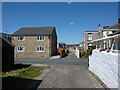
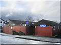
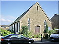
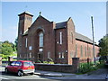
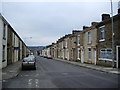
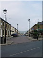
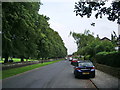
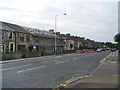
42 photos from this area
Area Information
Key information about the BB5 5PR including its size, population, and administrative classification.
- Area Type
- Postcode
- Area Size
- 3074 m²
- Population
- 1533
- Population Density
- 1142 people/km²
House Prices in BB5 5PR
16
Properties
£53,377
Average Sold Price
£18,000
Lowest Price
£90,500
Highest Price
Showing 16 properties
| Address | Type | Beds | Baths | Last Sale Price | Last Sale Date | |
|---|---|---|---|---|---|---|
| 13 Bayley Street, Clayton Le Moors, BB5 5PR | Terraced | 3 | 1 | £90,500 | Dec 2019 | |
| 11 Bayley Street, Clayton Le Moors, BB5 5PR | house | - | - | £75,000 | Nov 2013 | |
| 15 Bayley Street, Clayton Le Moors, BB5 5PR | Terraced | 2 | 1 | £62,950 | Nov 2010 | |
| 23 Bayley Street, Clayton Le Moors, BB5 5PR | house | - | - | £65,000 | Dec 2009 | |
| 3 Bayley Street, Clayton Le Moors, BB5 5PR | Terraced | 1 | 1 | £58,500 | May 2009 | |
| 17 Bayley Street, Clayton Le Moors, BB5 5PR | house | - | - | £55,000 | Aug 2006 | |
| 25 Bayley Street, Clayton Le Moors, BB5 5PR | Terraced | - | - | £60,000 | Apr 2005 | |
| 7 Bayley Street, Clayton Le Moors, BB5 5PR | Terraced | - | - | £18,000 | Apr 2004 | |
| 1 Bayley Street, Clayton Le Moors, BB5 5PR | Terraced | 3 | 1 | £28,000 | Feb 2004 | |
| 6 Bayley Street, Clayton Le Moors, BB5 5PR | house | 4 | - | £66,950 | Nov 2002 |
Page 1 of 2
Energy Efficiency in BB5 5PR
Amenities
Schools
| Rank | School | Type | Entry gender | Ages |
|---|
Explore more schools in this area
Go to Schools tabDemographics
Household Size
Two person
most common
Accommodation Type
Houses
most common
Tenure
72
majority
Ethnic Group
White
most common
Religion
N/A
most common
Household Composition
N/A
most common
Age
47
median
Adults (30-64 years)
most common
Household Deprivation
N/A
with no deprivation
NS-SEC
28
in Lower managerial occupations
Explore more demographic insights in this area
Go to Demographics tabPlanning
Planning Constraints
- Flood RiskPremium
- Ramsar Wetland SitesPremium
- Area of Outstanding Natural BeautyPremium
- Protected Nature ReservePremium
- Protected WoodlandPremium