Area Overview for BB5 5LQ
Photos of BB5 5LQ
Area Information
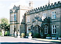
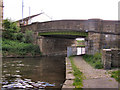
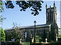
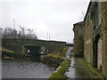
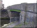
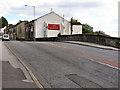
BB5 5LQ lies within Altham Ward, a small residential cluster in the Borough of Hyndburn, Lancashire. The area is steeped in history, with roots tracing back to Saxon times and a legacy of coal mining that shaped its economy until the mid-20th century. Today, it blends rural charm with modern convenience, situated 4 miles west of Burnley and near the River Calder. The village of Altham, which includes this postcode, is home to 1,758 residents, with a compact footprint that fosters a tight-knit community. St James Church, a Grade II* listed building dating to the 16th century, remains a focal point, while nearby industrial estates like Altham and Moorfield provide contemporary employment opportunities. Living here means balancing proximity to natural landscapes with access to nearby towns such as Accrington and Rawtenstall. The area’s character is defined by its historical architecture, family-oriented demographics, and practical connectivity to rail networks and retail hubs. For those seeking a quieter life with a touch of heritage, BB5 5LQ offers a distinct blend of tradition and modernity.
- Area Type
- Postcode
- Area Size
- Not available
- Population
- 1758
- Population Density
- 2643 people/km²
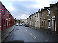
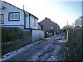
The property market in BB5 5LQ is characterised by a high rate of home ownership (67%) and a predominance of houses. This indicates a market skewed towards owner-occupied homes rather than rental properties, which is typical of smaller, rural communities. The focus on houses suggests a demand for family-friendly housing, likely with larger living spaces and gardens. Given the area’s small size and limited expansion potential, the housing stock is likely constrained, meaning buyers may encounter competition for available properties. The proximity to rail networks and retail amenities adds to the appeal, making it suitable for those seeking a balance between residential tranquility and practical connectivity. However, the lack of high-rise or mixed-use developments means the market is unlikely to cater to younger, transient populations or those prioritising urban living. For buyers, this suggests a niche market where properties are likely to retain value due to their rarity and the area’s stable demographics.
House Prices in BB5 5LQ
No properties found in this postcode.
Energy Efficiency in BB5 5LQ
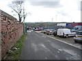
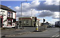
The lifestyle in BB5 5LQ is shaped by its proximity to retail and transport hubs. Nearby shops include Co-op Pickup, Asda Accrington, and Lidl Milnshaw, offering everyday essentials within practical reach. The rail stations provide access to a wider range of amenities in Accrington and beyond, while the Rawtenstall Metro station connects to further destinations. Though the area is residential, the Altham Industrial Estate and Moorfield Industrial Estate nearby suggest some employment opportunities, though the data does not specify local job sectors. The village’s historical sites, such as St James Church, add cultural value, while the surrounding countryside offers recreational potential. The mix of retail, transport, and heritage sites creates a balanced lifestyle, blending practicality with a sense of place.
Amenities
Schools
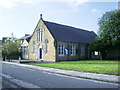
Residents of BB5 5LQ have access to a range of educational institutions, including Accrington Tutorial Centre, which serves as a secondary or further education provider. For primary education, Accrington St Christopher’s Church of England High School functions as both a primary and academy school, with an Ofsted rating of ‘good’. This dual designation offers families flexibility, combining early education with a structured academic pathway. The presence of a church-affiliated school suggests a community with strong local ties and a preference for established, well-rated institutions. While no data on student performance or specific facilities is provided, the ‘good’ rating indicates a reliable standard of teaching. Families seeking a mix of primary and secondary education within a short distance will find this area advantageous, though the absence of independent or specialist schools may limit options for those prioritising niche curricula.
| Rank | School | Type | Entry gender | Ages |
|---|
Explore more schools in this area
Go to Schools tabDemographics
The population of BB5 5LQ is predominantly adults aged 30–64, with a median age of 47. This suggests a community of middle-aged and older residents, many of whom may be established professionals or retirees. Home ownership is high at 67%, indicating a stable, long-term presence of residents. The accommodation type is primarily houses, reflecting a preference for family homes rather than flats or apartments. The predominant ethnic group is White, though specific data on other demographics is not provided. This age profile and ownership rate imply a mature, settled population with fewer transient residents. The absence of detailed diversity metrics means the community’s cultural makeup remains largely unexplored in the data. However, the presence of St James C.E. Primary School and nearby schools suggests a focus on family living. The area’s demographics align with a suburban lifestyle, where stability and local amenities are prioritised over urban vibrancy.
Household Size
Accommodation Type
Tenure
Ethnic Group
Religion
Household Composition
Age
Household Deprivation
NS-SEC
Explore more demographic insights in this area
Go to Demographics tabPlanning
Planning Constraints
- Flood RiskPremium
- Ramsar Wetland SitesPremium
- Area of Outstanding Natural BeautyPremium
- Protected Nature ReservePremium
- Protected WoodlandPremium