Area Overview for BB5 5HJ
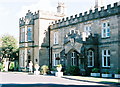
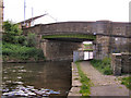
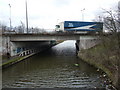
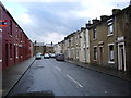
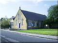
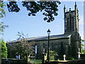
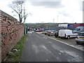
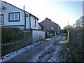
Photos of BB5 5HJ
Area Information
Living in BB5 5HJ means being part of a compact, residential cluster in the heart of Clayton-le-Moors, a town with roots in the 13th century and a history tied to the textile industry. The area’s population of 1,533 is concentrated in a small footprint, with a density of 1,142 people per square kilometre. This creates a tight-knit community feel, where daily life is shaped by proximity to local amenities and historical landmarks. The ward lies two miles north of Accrington, nestled between the River Calder and surrounding villages like Rishton and Great Harwood. While the area lacks large-scale infrastructure, its charm lies in its manageable size and accessibility to nearby towns via rail. Residents benefit from a blend of practical retail options, including Co-op Pickup and Tesco Blackburn, and regular train services from Huncoat, Accrington, and Rishton stations. The presence of two primary schools, including one rated ‘good’ by Ofsted, underscores the area’s appeal for families. BB5 5HJ is not for those seeking sprawling suburbs; it’s a place where community ties and historical character take precedence.
- Area Type
- Postcode
- Area Size
- Not available
- Population
- 1533
- Population Density
- 1142 people/km²
The property market in BB5 5HJ is dominated by owner-occupied homes, with 72% of residents living in houses rather than rented accommodation. This high home ownership rate indicates a stable, long-term resident base, likely with families seeking semi-detached or detached properties. The area’s small size means the housing stock is limited, with no indication of large-scale development or rental-focused properties. Given the high proportion of houses, buyers should expect a focus on traditional, family-friendly homes rather than apartments or flats. The compact nature of BB5 5HJ may mean that property searches extend to nearby wards like Rishton or Accrington, where larger housing options might be available. For those prioritising security and community, the area’s low flood risk and proximity to rail links make it appealing. However, the limited housing stock could lead to competition among buyers, particularly for properties near the two primary schools.
House Prices in BB5 5HJ
No properties found in this postcode.
Energy Efficiency in BB5 5HJ
Daily life in BB5 5HJ is shaped by its proximity to practical amenities and a modest selection of retail options. The area has five notable retail venues, including Co-op Pickup, Aldi Great, and Tesco Blackburn, providing residents with access to groceries, household goods, and convenience services. These stores are within walking or short driving distance, reducing the need for long trips to larger towns. The railway stations—Huncoat, Accrington, and Rishton—offer regular services to nearby cities, enhancing access to cultural, leisure, and employment opportunities. While the area does not list parks or leisure facilities in the data, its small size suggests a focus on community spaces rather than large-scale recreational amenities. The presence of two primary schools and a stable, middle-aged population contributes to a quiet, family-oriented lifestyle. Residents benefit from a balance of practicality and historical character, with limited but sufficient amenities to support daily living.
Amenities
Schools
Residents of BB5 5HJ have access to two primary schools: Clayton-le-Moors All Saints Church of England Primary School and Clayton-le-Moors All Saints’ Church of England Primary School. Both are state-funded and serve the local community, though the second school holds an Ofsted rating of ‘good’. This mix of schools provides families with options, with one offering a higher standard of education. The presence of two primary schools within practical reach suggests the area is well-served for children aged 4–11. However, no secondary schools are listed in the data, meaning students may need to travel to nearby towns like Accrington or Blackburn for secondary education. For families prioritising primary education, the ‘good’ rating at one school is a positive factor, but the lack of detailed performance metrics for both schools means further research would be needed to compare their curricula or facilities.
| Rank | School | Type | Entry gender | Ages |
|---|
Explore more schools in this area
Go to Schools tabDemographics
The population of BB5 5HJ skews towards adults aged 30–64, with a median age of 47. This suggests a stable, middle-aged community, likely composed of long-term residents and families. Home ownership is high at 72%, with the majority of properties being houses rather than flats or apartments. The predominant ethnic group is White, reflecting the area’s historical and cultural continuity. The demographic profile indicates a low proportion of younger or older residents, which may influence local services and amenities. For instance, the presence of two primary schools aligns with the need for education for children in this age bracket. The absence of specific data on deprivation means the quality of life can be inferred from the area’s amenities and safety profile. With no protected natural areas or flood risks, residents face fewer environmental constraints. However, the medium crime risk score of 45 suggests standard security measures are prudent. Overall, BB5 5HJ caters to a settled, family-oriented population with limited diversity in age or ethnicity.
Household Size
Accommodation Type
Tenure
Ethnic Group
Religion
Household Composition
Age
Household Deprivation
NS-SEC
Explore more demographic insights in this area
Go to Demographics tabPlanning
Planning Constraints
- Flood RiskPremium
- Ramsar Wetland SitesPremium
- Area of Outstanding Natural BeautyPremium
- Protected Nature ReservePremium
- Protected WoodlandPremium