Area Overview for BB5 5GL
Photos of BB5 5GL
Area Information
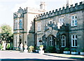
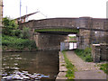
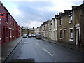
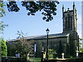
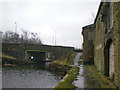
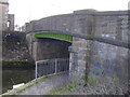
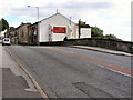
Living in BB5 5GL means being part of a tightly knit residential cluster in the heart of Clayton-le-Moors, a town with a rich industrial heritage. The postcode covers a small, densely populated area of 1,533 residents, with a population density of 1,142 people per square kilometre. This compact community is centred around the coordinates 53.772899, -2.39142, nestled two miles north of Accrington. Historically a hub for the cotton textile industry, the area’s character is shaped by its 19th-century mills and the Leeds and Liverpool Canal, which once spurred economic growth. Today, daily life balances modern convenience with historical roots. Residents benefit from nearby rail links, including Rishton and Accrington stations, and a range of local shops. The area’s small size means a strong sense of local identity, though its proximity to larger towns like Blackburn and Accrington offers access to broader services. For those seeking a quiet, community-focused environment with practical connectivity, BB5 5GL offers a blend of tradition and accessibility.
- Area Type
- Postcode
- Area Size
- Not available
- Population
- 1533
- Population Density
- 1142 people/km²
The property market in BB5 5GL is characterised by high home ownership (72%) and a predominance of houses, suggesting a focus on owner-occupied properties rather than rental units. This indicates a stable, long-term housing stock, with fewer speculative investments or transient tenants. The concentration of houses implies a preference for larger, more private living spaces, which may appeal to families or individuals seeking space. Given the area’s small size and limited land availability, property values are likely constrained by supply, though the high home ownership rate suggests a degree of affordability for residents. For buyers, this means a market where properties are more likely to be held by long-term owners, reducing the risk of sudden price fluctuations. However, the limited data on property types or prices means potential buyers should consider the broader Hyndburn Borough context for a fuller picture of the local real estate landscape.
House Prices in BB5 5GL
No properties found in this postcode.
Energy Efficiency in BB5 5GL
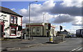
The lifestyle in BB5 5GL is shaped by its proximity to essential amenities. Locally, residents can access five retail venues, including Co-op Pickup, Aldi Great, and Tesco Blackburn, offering convenience for everyday shopping. The rail network provides access to nearby towns, with stations like Accrington and Rishton enabling easy travel for work, leisure, or socialising. While the data does not mention parks or leisure facilities directly, the area’s historical industrial roots suggest a mix of utilitarian and community spaces. The presence of multiple retail options and rail links indicates a practical, community-focused lifestyle, though larger leisure opportunities may require venturing to Blackburn or Preston. For those valuing accessibility and a balance between local convenience and regional connectivity, BB5 5GL provides a functional base with a strong emphasis on practicality.
Amenities
Schools
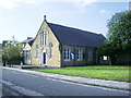
Residents of BB5 5GL have access to two primary schools within practical reach: Clayton-le-Moors All Saints Church of England Primary School and Clayton-le-Moors All Saints’ Church of England Primary School, both rated ‘good’ by Ofsted. These institutions serve the local community, offering a solid foundation for early education. The presence of two primary schools suggests a focus on supporting families with young children, though no secondary schools are listed in the data. For parents, this means a reliable choice for primary education, though further schooling may require commuting to nearby towns like Accrington or Blackburn. The ‘good’ Ofsted ratings indicate that both schools meet national standards, providing reassurance about the quality of teaching and resources. Families prioritising strong primary education will find this a significant advantage, though they should plan for secondary schooling options beyond the immediate area.
| Rank | School | Type | Entry gender | Ages |
|---|
Explore more schools in this area
Go to Schools tabDemographics
The population of BB5 5GL skews towards adults aged 30–64, with a median age of 47. This suggests a mature, established community, likely with a mix of long-term residents and families. Home ownership is high at 72%, indicating a stable housing market and a predominance of owner-occupied properties. The area’s accommodation is primarily houses, which aligns with the higher proportion of family households. The predominant ethnic group is White, reflecting the broader demographic trends in the North West region. While no specific data on deprivation is provided, the high home ownership rate and moderate population density suggest a relatively stable quality of life. The absence of significant diversity metrics means the community’s social composition remains largely homogenous, with no explicit indicators of socioeconomic disparity. This profile paints a picture of a settled, family-oriented area with a focus on long-term residency.
Household Size
Accommodation Type
Tenure
Ethnic Group
Religion
Household Composition
Age
Household Deprivation
NS-SEC
Explore more demographic insights in this area
Go to Demographics tabPlanning
Planning Constraints
- Flood RiskPremium
- Ramsar Wetland SitesPremium
- Area of Outstanding Natural BeautyPremium
- Protected Nature ReservePremium
- Protected WoodlandPremium