Area Overview for BB5 4PS
Photos of BB5 4PS
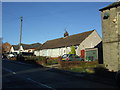
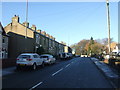
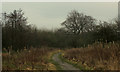
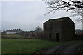
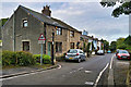
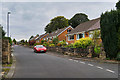
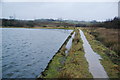
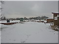
25 photos from this area
Area Information
Key information about the BB5 4PS including its size, population, and administrative classification.
- Area Type
- Postcode
- Area Size
- 30.4 hectares
- Population
- 1608
- Population Density
- 1296 people/km²
House Prices in BB5 4PS
32
Properties
£105,726
Average Sold Price
£12,950
Lowest Price
£230,000
Highest Price
Showing 32 properties
| Address | Type | Beds | Baths | Last Sale Price | Last Sale Date | |
|---|---|---|---|---|---|---|
| 31 Stanhill Road, Oswaldtwistle, BB5 4PS | Terraced | 2 | 1 | £165,000 | Jul 2024 | |
| 29 Stanhill Road, Oswaldtwistle, BB5 4PS | Terraced | 2 | 1 | £145,000 | Jun 2024 | |
| 35 Stanhill Road, Oswaldtwistle, BB5 4PS | Detached | - | - | £230,000 | Jan 2022 | |
| 93 Stanhill Road, Oswaldtwistle, BB5 4PS | Terraced | 3 | 1 | £182,000 | Mar 2020 | |
| 33 Stanhill Road, Oswaldtwistle, BB5 4PS | Cottage | 1 | 1 | £75,500 | Sep 2019 | |
| 49 Stanhill Road, Oswaldtwistle, BB5 4PS | Terraced | 3 | 1 | £173,000 | Jul 2018 | |
| 37 Stanhill Road, Oswaldtwistle, BB5 4PS | Detached | - | - | £165,000 | Apr 2017 | |
| 51 Stanhill Road, Oswaldtwistle, BB5 4PS | Terraced | 2 | 1 | £80,000 | Feb 2012 | |
| 83 Stanhill Road, Oswaldtwistle, BB5 4PS | Semi-detached | - | - | £220,000 | Sep 2006 | |
| 65 Stanhill Road, Oswaldtwistle, BB5 4PS | Terraced | - | - | £68,000 | Oct 2002 |
Page 1 of 4
Energy Efficiency in BB5 4PS
Amenities
Schools
| Rank | School | Type | Entry gender | Ages |
|---|
Explore more schools in this area
Go to Schools tabDemographics
Household Size
Two person
most common
Accommodation Type
Houses
most common
Tenure
86
majority
Ethnic Group
White
most common
Religion
N/A
most common
Household Composition
N/A
most common
Age
47
median
Adults (30-64 years)
most common
Household Deprivation
N/A
with no deprivation
NS-SEC
33
in Lower managerial occupations
Explore more demographic insights in this area
Go to Demographics tabPlanning
Planning Constraints
- Flood RiskPremium
- Ramsar Wetland SitesPremium
- Area of Outstanding Natural BeautyPremium
- Protected Nature ReservePremium
- Protected WoodlandPremium