Area Overview for BB5 4EW
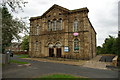
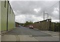
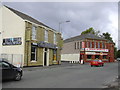
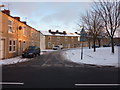
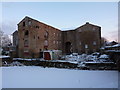
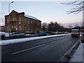
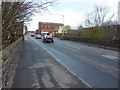
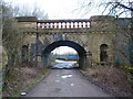
Photos of BB5 4EW
Area Information
Living in BB5 4EW offers a quiet, tightly knit residential experience in a small cluster of homes. With a population of 1,223, the area feels intimate, where daily life is shaped by proximity to local amenities and practical transport links. The community is predominantly composed of adults aged 30–64, reflecting a stable demographic. While the area is small, it is well-served by nearby retail hubs, rail stations, and a primary school, making it convenient for families and commuters. BB5 4EW’s character lies in its balance of residential calm and accessibility to larger services. Residents can access major supermarkets like Asda and Lidl within short distances, while rail connections to Accrington and beyond provide easy access to urban centres. The area’s low flood risk and absence of environmental restrictions suggest a straightforward planning landscape, though standard security measures are advisable given the moderate crime risk. For those seeking a self-contained yet connected lifestyle, BB5 4EW offers a pragmatic base.
- Area Type
- Postcode
- Area Size
- Not available
- Population
- 1223
- Population Density
- 1955 people/km²
BB5 4EW’s property market is defined by a 64% home ownership rate, indicating a balance between owner-occupied homes and rental properties. The area is predominantly composed of houses, which is unusual for smaller postcode clusters and suggests a focus on single-family residences. This housing stock appeals to buyers seeking stability, as the absence of environmental constraints like protected woodlands or AONB designations simplifies planning for renovations or extensions. However, the small size of the area means the housing market is limited, and buyers may need to consider nearby regions for more options. The predominance of owner-occupied properties also implies a community of long-term residents, which can be a factor for those prioritising a settled neighbourhood.
House Prices in BB5 4EW
No properties found in this postcode.
Energy Efficiency in BB5 4EW
The lifestyle in BB5 4EW is supported by nearby amenities, including five retail outlets such as Lidl Milnshaw, Asda Accrington, and Farmfoods Milnshaw, offering everyday shopping convenience. Rail stations provide access to urban centres, while the Rawtenstall metro station enhances regional connectivity. Though the area itself is small, its proximity to larger services means residents can enjoy a mix of local convenience and broader opportunities. The presence of a primary school and accessible transport options contributes to a balanced lifestyle, blending residential tranquillity with practicality.
Amenities
Schools
The nearest school to BB5 4EW is St Nicholas Church of England Primary School, which serves the area with a good Ofsted rating. This primary school is a key asset for families, though secondary education options are not listed in the data. The presence of a well-rated primary school supports the area’s appeal to households with young children, though parents may need to look further afield for secondary schooling. The school’s rating suggests a focus on quality education, which can be a deciding factor for families prioritising local schooling.
| Rank | School | Type | Entry gender | Ages |
|---|
Explore more schools in this area
Go to Schools tabDemographics
The population of BB5 4EW is 1,223, with a median age of 47, indicating a mature community. The most common age range is adults aged 30–64, suggesting a stable, established demographic. Home ownership rates stand at 64%, reflecting a mix of owner-occupied properties and rental units. The predominant accommodation type is houses, aligning with the area’s residential character. The predominant ethnic group is White, though no further diversity data is provided. This age profile and ownership structure imply a community focused on long-term residency rather than transient populations. The absence of specific deprivation data means quality of life considerations remain unquantified, but the demographic stability suggests consistent local services and infrastructure.
Household Size
Accommodation Type
Tenure
Ethnic Group
Religion
Household Composition
Age
Household Deprivation
NS-SEC
Explore more demographic insights in this area
Go to Demographics tabPlanning
Planning Constraints
- Flood RiskPremium
- Ramsar Wetland SitesPremium
- Area of Outstanding Natural BeautyPremium
- Protected Nature ReservePremium
- Protected WoodlandPremium