Area Overview for BB5 3DS
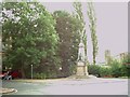
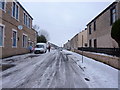
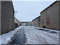
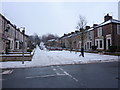
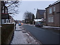
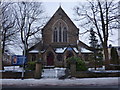
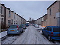
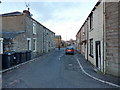
Photos of BB5 3DS
Area Information
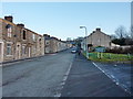
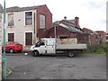
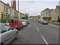
Living in BB5 3DS means being part of a small, tightly knit residential cluster in the heart of Oswaldtwistle, Lancashire. With a population of 1,742, this area is compact yet functional, serving as a quiet corner of Hyndburn Borough Council. The community is predominantly composed of adults aged 30–64, reflecting a mature demographic profile. The area’s history is rooted in its name, which may trace back to Anglo-Saxon origins or references to King Oswald, though this remains debated by historians. Daily life here is shaped by proximity to local amenities, including shops, rail links, and schools. Residents benefit from strong digital connectivity and a strategic location near multiple railway stations, making it accessible for commuters. While the area lacks sprawling green spaces, its urban character is complemented by a focus on practicality, with homes designed for family living. BB5 3DS is not a place for those seeking isolation; it thrives on the convenience of nearby services and the rhythm of a close-knit community.
- Area Type
- Postcode
- Area Size
- Not available
- Population
- 1742
- Population Density
- 4035 people/km²
The property market in BB5 3DS is dominated by owner-occupied homes, with 55% of properties in private hands. This contrasts with areas where rental demand drives the market, suggesting a focus on long-term residency rather than short-term investment. The accommodation type is exclusively houses, indicating a lack of high-density housing or flats. For buyers, this means the available stock is limited to standalone properties, which may appeal to families or those prioritising space. The small size of the area means that property choices are constrained, and buyers may need to look beyond BB5 3DS itself to find additional options. The prevalence of houses also implies that the area is less suited to those seeking modern, low-maintenance living, though it offers a traditional, settled feel.
House Prices in BB5 3DS
No properties found in this postcode.
Energy Efficiency in BB5 3DS
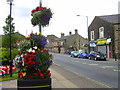
The lifestyle in BB5 3DS is shaped by its proximity to retail, rail, and transport hubs. Five retail outlets, including Tesco Oswaldtwistle and Spar, provide everyday shopping convenience. The area’s rail network, with five stations and a metro link, ensures easy access to nearby towns, enhancing both commuting and leisure opportunities. While the data does not mention parks or leisure facilities, the presence of multiple railway stations suggests a focus on connectivity over green spaces. For residents, this means a practical, service-oriented lifestyle with minimal need to travel far for essentials. The area’s compact size means amenities are within walking or short driving distance, though those seeking extensive recreational spaces may need to look beyond the immediate vicinity.
Amenities
Schools
Residents of BB5 3DS have access to two key educational institutions. The primary school, Oswaldtwistle St Paul’s Church of England Primary School, is rated ‘good’ by Ofsted, offering a solid foundation for younger children. The second school, Oswaldtwistle School, is listed as an ‘other’ type, though its specific role—whether secondary or specialist—is not detailed. This mix of school types provides families with options, though the absence of additional schools means parents may need to consider nearby areas for secondary education. The proximity of these institutions to homes underscores the area’s suitability for families, with schools within practical reach. However, the limited number of schools could be a consideration for those requiring multiple educational choices.
| Rank | School | Type | Entry gender | Ages |
|---|
Explore more schools in this area
Go to Schools tabDemographics
The demographic profile of BB5 3DS is defined by its median age of 47, with the majority of residents falling within the 30–64 age range. This suggests a community of established professionals and families, rather than a transient population. Home ownership is robust, with 55% of properties occupied by owners, while the remaining 45% are likely rented. The area is characterised by houses rather than flats, reflecting a preference for standalone homes. The predominant ethnic group is White, which aligns with broader trends in the region. The absence of specific data on deprivation means this aspect is not quantified, but the age profile and home ownership rates imply a stable, middle-income community. The urban nature of St. Andrew’s Ward, which includes BB5 3DS, further reinforces this stability, with services and infrastructure tailored to a mature demographic.
Household Size
Accommodation Type
Tenure
Ethnic Group
Religion
Household Composition
Age
Household Deprivation
NS-SEC
Explore more demographic insights in this area
Go to Demographics tabPlanning
Planning Constraints
- Flood RiskPremium
- Ramsar Wetland SitesPremium
- Area of Outstanding Natural BeautyPremium
- Protected Nature ReservePremium
- Protected WoodlandPremium