Area Overview for BB5 2XQ
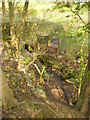
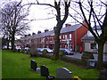
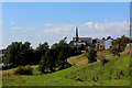
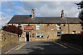
Photos of BB5 2XQ
Area Information
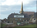
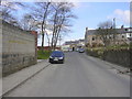
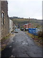
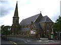
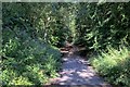
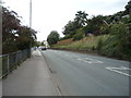
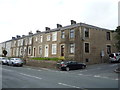
Living in BB5 2XQ means being part of a small, tightly knit residential cluster in the Borough of Hyndburn, Lancashire. The postcode area covers a compact community with a population of 1,182 people, spread across 344 residents per square kilometre. Situated in Baxenden, a village with historical roots, the area is part of a larger electoral ward that saw 4,042 residents in the 2011 census, suggesting BB5 2XQ itself is a smaller, more focused locality. The character here is defined by its low population density and proximity to nearby towns like Accrington, which offers a range of services. Daily life is shaped by a mature demographic, with a median age of 47, and a strong presence of households in the 30-64 age range. The area is predominantly owner-occupied, with 92% of homes in private ownership, and most properties are houses rather than flats. This suggests a stable, long-term community with a focus on family living. The nearby Baxenden St John’s Church of England Primary School and access to rail networks highlight the practicalities of life here, blending local charm with essential connectivity.
- Area Type
- Postcode
- Area Size
- Not available
- Population
- 1182
- Population Density
- 344 people/km²
The property market in BB5 2XQ is dominated by owner-occupied homes, with 92% of properties in private hands. This high rate of home ownership indicates a community where residents are likely to have long-term ties to the area, rather than a transient rental market. The accommodation type is predominantly houses, which contrasts with areas where flats or apartments dominate. This suggests a housing stock that caters to families or individuals seeking more space, rather than urban dwellers. Given the small size of the postcode area, the property market is likely limited in scale, with fewer options for buyers compared to larger towns. However, the proximity to nearby towns like Accrington and the presence of rail links may provide additional choices for those willing to consider surrounding areas. For buyers, the focus on houses and high home ownership means a competitive market for those seeking to purchase within BB5 2XQ itself, with potential for long-term value retention.
House Prices in BB5 2XQ
No properties found in this postcode.
Energy Efficiency in BB5 2XQ
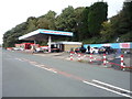
The lifestyle in BB5 2XQ is supported by nearby amenities that cater to daily needs. Retail options include five notable venues such as Tesco Baxenden, Tesco Accrington Abbey, and Iceland Accrington, providing access to groceries and convenience stores. These shops are within practical reach, making it easy to manage household errands. The area’s rail network connects residents to larger towns, offering access to more extensive leisure and dining options. While the immediate vicinity lacks detailed information on parks or recreational spaces, the proximity to Hyndburn and surrounding areas likely provides opportunities for outdoor activities. The blend of local retail, transport links, and a low population density creates a balance between convenience and a quieter, community-focused environment.
Amenities
Schools
The nearest school to BB5 2XQ is Baxenden St John’s Church of England Primary School, which serves the local community with a good Ofsted rating. This primary school is a key asset for families in the area, offering a solid foundation for early education. The absence of secondary schools in the immediate vicinity means residents may need to travel to nearby towns for secondary education, such as Accrington or Rawtenstall. The presence of a primary school with a good rating suggests that the area is well-served for younger children, though parents should consider the broader educational landscape when planning for older children. The school’s religious affiliation and rating indicate a focus on community values and academic standards, which may appeal to families prioritising these aspects.
| Rank | School | Type | Entry gender | Ages |
|---|
Explore more schools in this area
Go to Schools tabDemographics
The community in BB5 2XQ is predominantly composed of adults aged 30-64, with a median age of 47. This suggests a mature population, likely with established careers and family structures. Home ownership is exceptionally high, at 92%, indicating a strong preference for long-term residency over rental properties. The area is characterised by houses rather than flats, reflecting a residential profile suited to larger families or those seeking more space. The predominant ethnic group is White, though specific data on diversity is not provided. The low population density of 344 people per square kilometre implies a spread-out, less congested environment. This demographic profile aligns with a community that values stability and privacy, with fewer transient residents. The absence of detailed information on deprivation or income levels means the quality of life can only be inferred from the high home ownership and low crime risk, which together suggest a relatively affluent and secure living environment.
Household Size
Accommodation Type
Tenure
Ethnic Group
Religion
Household Composition
Age
Household Deprivation
NS-SEC
Explore more demographic insights in this area
Go to Demographics tabPlanning
Planning Constraints
- Flood RiskPremium
- Ramsar Wetland SitesPremium
- Area of Outstanding Natural BeautyPremium
- Protected Nature ReservePremium
- Protected WoodlandPremium