Area Overview for BB5 2NT
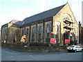
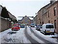
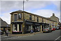
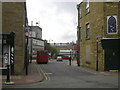
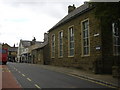
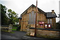
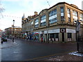
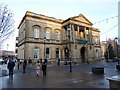
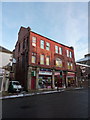
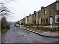
Photos of BB5 2NT
Area Information
BB5 2NT represents a specific residential cluster situated within the Barnfield Ward of Hyndburn Borough Council. This tightly defined postcode covers an area of just 5665 square metres, housing a population of 1718 people. Such a high population density of 303,276 people per square kilometre indicates a compact, inner-city neighbourhood rather than a spacious suburban sprawl. Living in BB5 2NT means navigating a dense environment where residents are living in close proximity to one another. The location forms part of the broader suburban expansion found around Accrington, positioning the neighbourhood within the North West of England. Prospective homebuyers should understand that this area is defined by its specific boundaries and immediate context. The small physical footprint distinguishes BB5 2NT from wider catchment areas, creating a localised community focus. You will find yourselves in a zone that acts as a functional part of the larger Accrington district. The area's character is shaped by its role as a residential hub within a larger urban framework. Understanding the scale of BB5 2NT is essential for managing expectations regarding space and local connections.
- Area Type
- Postcode
- Area Size
- 5665 m²
- Population
- Not available
- Population Density
- Not available
The housing stock in BB5 2NT is characterised by a specific residential type profile. Data confirms that Houses constitute the primary accommodation type available for residents within this postcode. This structural preference shapes the available market inventory, offering traditional properties rather than high-rise blocks or flats. Home ownership stands at 32%, a figure that indicates a mixed market where roughly one-third of the population owns their dwelling. The remaining two-thirds reside in rented accommodation, suggesting a dynamic environment with significant turnover or specific tenancy arrangements common in dense urban clusters. Buying homes in BB5 2NT requires navigating a market defined by limited physical space due to the postcode's small size of 5665 square metres. The predominance of houses suggests buyers seeking single-family units will find their primary option here. The low ownership percentage implies that new buyers may face competition from established tenants or local agencies managing rental stock. This area serves as part of the wider Accrington housing corridor, meaning property values and demand are linked to the broader local economy. You should anticipate a market where the scarcity of new builds in such a tiny footprint makes established homes the primary asset class.
House Prices in BB5 2NT
Showing 2 properties
| Address | Type | Beds | Baths | Last Sale Price | Last Sale Date | |
|---|---|---|---|---|---|---|
| 66A Wellington Street, Accrington, BB5 2NT | Terraced | 2 | 1 | - | - | |
| 70B Wellington Street, Accrington, BB5 2NT | Flat | - | - | - | - |
Energy Efficiency in BB5 2NT
Daily life in BB5 2NT centres on a small cluster of amenities located within practical reach of homes. Retail options include five locations, notably Tesco Accrington Abbey, Iceland Accrington, and Tesco Accrington, ensuring access to groceries and daily essentials. Transport links support mobility, with five rail stations nearby including Accrington Railway Station. For those requiring light rail access, Rawtenstall metro station provides an option within the wider network. These facilities combine to create a neighbourhood where daily chores and commuting are manageable. Residents can shop for groceries at Tesco or Iceland without travelling far. The presence of multiple railway stations means you have several options for catching trains depending on your destination or schedule. While the area itself is compact at 5665 square metres, the surrounding amenities compensate for the limited internal space. You will find that essential services are close by, reducing the need for lengthy car journeys for routine tasks. The concentration of retail and transport hubs allows for a convenient lifestyle despite the dense residential layout.
Amenities
Schools
Families living near BB5 2NT have access to a specific mix of educational facilities within practical reach. The closest educational institution is Accrington and Rossendale College, which operates as a sixth-form college providing further education for older students. For those seeking independent schooling, The Alternative School offers an independent curriculum and holds a good Ofsted rating, indicating a standard of quality recognised by regulators. Secondary education options include Hyndburn Studio School, which serves students within the secondary age bracket. This combination of institutions offers distinct pathways for students based on educational needs. The presence of a sixth-form college means older students can access higher education training without commuting further out of the local area. The independent status of The Alternative School provides a homogeneous educational environment compared to the state-maintained Hyndburn Studio School. When considering schools for children, these three venues represent the complete educational landscape immediately available to residents of BB5 2NT. No other schools are listed in the data, meaning parents must coordinate their children's education around these specific three providers. The school types range from vocational and independent to state secondary, offering variety within the immediate vicinity.
| Rank | School | Type | Entry gender | Ages |
|---|
Explore more schools in this area
Go to Schools tabDemographics
The community within BB5 2NT reflects a mature demographic profile designed for stability. The median age stands at 47 years, confirming that Adults aged between 30 and 64 years constitute the most common age range in the postcode. This distribution suggests a population comprised of established families or those nearing retirement. Home ownership figures reveal that 32% of residents own their properties outright or via mortgage. While this indicates a significant minority of owner-occupiers, the majority likely reside in rental accommodation or shared ownership schemes. Accommodation types in BB5 2NT predominantly consist of Houses, defining the physical nature of the streetscape. The predominant ethnic group within the population is White, shaping the cultural demographics of the area. For residents looking to join this community, the age profile suggests a neighbourhood accustomed to long-term living arrangements. The concentration of adults in their prime working and family-building years drives the local demand for practical housing solutions. You can expect a community where the majority of residents fall within the standard working-age bracket, contributing to a stable residential environment. Specific social indicators show a clear segmentation between age groups, with older adults and younger children representing smaller portions of the total population count.
Household Size
Accommodation Type
Tenure
Ethnic Group
Religion
Household Composition
Age
Household Deprivation
NS-SEC
Explore more demographic insights in this area
Go to Demographics tabPlanning
Planning Constraints
- Flood RiskPremium
- Ramsar Wetland SitesPremium
- Area of Outstanding Natural BeautyPremium
- Protected Nature ReservePremium
- Protected WoodlandPremium