Area Overview for BB5 2AJ
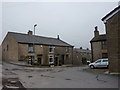
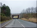
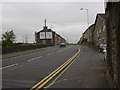
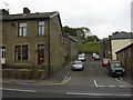
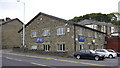
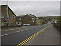
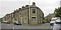
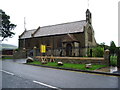
Photos of BB5 2AJ
Area Information
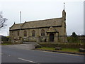
BB5 2AJ is a small residential cluster in England, encompassing 1,043 m² with a population of 1,561. Situated in Haslingden, a market town in Rossendale, Lancashire, the area reflects a blend of historical industrial heritage and modern residential living. Haslingden itself dates to the 13th century, once a hub for wool and cotton industries during the Industrial Revolution. Today, the area retains a quiet, community-focused character, with a median age of 47 and a population skewed toward adults aged 30–64. The low population density of 160 people per km² suggests a mix of established homes and smaller family units. Residents benefit from proximity to nearby towns like Accrington and Rawtenstall, with rail links to major cities. The area’s safety profile is strong, with a crime risk score of 71, and no significant environmental risks like flood zones or protected natural areas. Schools such as St John’s Stonefold CofE Primary School and Austen House cater to families, while local amenities including Tesco and rail stations ensure daily convenience. BB5 2AJ offers a peaceful, low-maintenance lifestyle with access to both historical and contemporary resources.
- Area Type
- Postcode
- Area Size
- 1043 m²
- Population
- 1561
- Population Density
- 160 people/km²
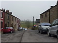
The property market in BB5 2AJ is characterised by a high rate of home ownership (73%) and a focus on houses as the primary accommodation type. This suggests a market dominated by owner-occupied properties, with fewer rental units compared to other areas. The small area size and residential cluster nature of BB5 2AJ mean that properties are likely to be family homes, offering space and privacy. For buyers, this implies a market that prioritises long-term investment over short-term rental opportunities. The limited number of properties in the area may also mean competition for available homes, particularly for those seeking specific features like garden space or proximity to local amenities. The presence of nearby towns like Accrington and Rawtenstall could provide additional options for buyers looking beyond BB5 2AJ itself. The combination of high home ownership and house-centric housing stock indicates a community that values stability and permanence.
House Prices in BB5 2AJ
Showing 1 properties
| Address | Type | Beds | Baths | Last Sale Price | Last Sale Date | |
|---|---|---|---|---|---|---|
| Healden Grove Limited, Healden Grove House, Blackburn Road, Rising Bridge, Accrington, BB5 2AJ | Office | - | - | - | - |
Energy Efficiency in BB5 2AJ
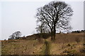
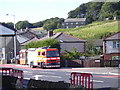
Living in BB5 2AJ offers a blend of convenience and historical character. Nearby retail options such as Tesco Baxenden, Co-op Haslingden, and Tesco Accrington Abbey provide essential shopping, while rail stations like Accrington and Church & Oswaldtwistle connect residents to broader networks. The area’s proximity to Rawtenstall and Ramsbottom metro stations further expands mobility. Though specific parks or leisure facilities are not detailed in the data, the historical context of Haslingden—once a hub for wool and cotton industries—adds cultural depth. The presence of notable sites like the former workhouse on Spring Lane and stone quarries that supplied Trafalgar Square suggests a heritage-rich environment. For daily life, the area’s low population density and accessible amenities create a balance between tranquillity and practicality, ideal for those seeking a manageable, community-oriented lifestyle.
Amenities
Schools
Residents of BB5 2AJ have access to two notable schools: St John’s Stonefold CofE Primary School, a state-funded primary school with a good Ofsted rating, and Austen House, an independent school also rated good. The mix of state and independent education options provides families with flexibility in choosing their children’s schooling. St John’s Stonefold CofE Primary School likely caters to younger children, offering a community-focused education, while Austen House may provide specialist or alternative learning environments. The presence of two schools with strong ratings suggests that the area is appealing to families prioritising quality education. However, the absence of secondary schools in the immediate vicinity may require residents to consider commuting to nearby towns for secondary education. This combination of school types ensures a range of choices but also highlights the need for planning when considering long-term family needs.
| Rank | School | Type | Entry gender | Ages |
|---|
Explore more schools in this area
Go to Schools tabDemographics
The community in BB5 2AJ is predominantly composed of adults aged 30–64, with a median age of 47. This suggests a stable population of middle-aged residents, many of whom may be established professionals or families with children. Home ownership is high, at 73%, indicating a strong presence of owner-occupied properties. The accommodation type is primarily houses, reflecting a residential area focused on single-family homes rather than apartments or flats. The predominant ethnic group is White, which aligns with broader demographic trends in the region. The absence of specific data on deprivation or diversity means the area’s social dynamics are not explicitly detailed, but the high home ownership rate and age profile suggest a relatively affluent, settled community. The low population density of 160 people per km² further implies a spread-out, less congested environment, which may appeal to those seeking space and tranquillity.
Household Size
Accommodation Type
Tenure
Ethnic Group
Religion
Household Composition
Age
Household Deprivation
NS-SEC
Explore more demographic insights in this area
Go to Demographics tabPlanning
Planning Constraints
- Flood RiskPremium
- Ramsar Wetland SitesPremium
- Area of Outstanding Natural BeautyPremium
- Protected Nature ReservePremium
- Protected WoodlandPremium