Area Overview for BB5 0NG
Photos of BB5 0NG
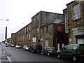
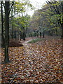
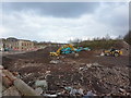
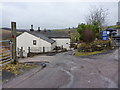
33 photos from this area
Area Information
Key information about the BB5 0NG including its size, population, and administrative classification.
- Area Type
- Postcode
- Area Size
- 1.9 hectares
- Population
- 1751
- Population Density
- 2892 people/km²
House Prices in BB5 0NG
38
Properties
£87,304
Average Sold Price
£140
Lowest Price
£175,000
Highest Price
Showing 38 properties
| Address | Type | Beds | Baths | Last Sale Price | Last Sale Date | |
|---|---|---|---|---|---|---|
| 3 Lindadale Avenue, Accrington, BB5 0NG | Semi-detached | 3 | 1 | £132,000 | Oct 2024 | |
| 10 Lindadale Avenue, Accrington, BB5 0NG | Terraced | 3 | 1 | £130,500 | May 2024 | |
| 6 Lindadale Avenue, Accrington, BB5 0NG | house | 3 | 1 | £142,000 | Apr 2024 | |
| 43 Lindadale Avenue, Accrington, BB5 0NG | Semi-detached | 3 | 1 | £175,000 | Aug 2023 | |
| 9 Lindadale Avenue, Accrington, BB5 0NG | Semi-detached | 4 | 2 | £158,000 | May 2020 | |
| 20 Lindadale Avenue, Accrington, BB5 0NG | Detached | 4 | 1 | £140 | Aug 2018 | |
| 11 Lindadale Avenue, Accrington, BB5 0NG | Semi-detached | 3 | 1 | £95,000 | Feb 2015 | |
| 23 Lindadale Avenue, Accrington, BB5 0NG | Semi-detached | 3 | 1 | £63,500 | Aug 2013 | |
| 21 Lindadale Avenue, Accrington, BB5 0NG | house | 3 | 1 | £45,000 | Apr 2012 | |
| 13 Lindadale Avenue, Accrington, BB5 0NG | house | 3 | - | £74,950 | Apr 2011 |
Page 1 of 4
Energy Efficiency in BB5 0NG
Amenities
Schools
| Rank | School | Type | Entry gender | Ages |
|---|
Explore more schools in this area
Go to Schools tabDemographics
Household Size
Family (3-5 people)
most common
Accommodation Type
Houses
most common
Tenure
64
majority
Ethnic Group
asian_total
most common
Religion
N/A
most common
Household Composition
N/A
most common
Age
47
median
Adults (30-64 years)
most common
Household Deprivation
N/A
with no deprivation
NS-SEC
11
in Lower managerial occupations
Explore more demographic insights in this area
Go to Demographics tabPlanning
Planning Constraints
- Flood RiskPremium
- Ramsar Wetland SitesPremium
- Area of Outstanding Natural BeautyPremium
- Protected Nature ReservePremium
- Protected WoodlandPremium