Area Overview for BB4 9DD
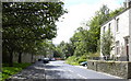
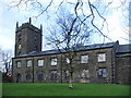
Photos of BB4 9DD


Area Information
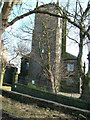
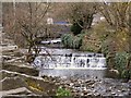
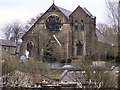
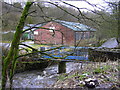
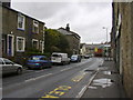
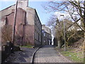
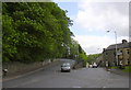
Living in BB4 9DD means residing within a specific residential cluster in Waterfoot, Lancashire, a historic mill town located between Rawtenstall and Bacup. The area covers 4,493 square metres and supports a population of 1,454 residents, resulting in a very high population density. This postcode serves a community deeply rooted in the borough of Rossendale, positioned at the confluence of Whitewell Brook and the River Irwell where the B6238 road meets the A681. You are entering a location defined by its industrial heritage, particularly its history in felt-making and cotton production since the 1770s. The area was not always known by this name; the main centre was previously Newchurch-in-Rossendale, situated to the north and recorded with a population of 1,000 people in 1511. Industrialisation drove the expansion of Waterfoot during the nineteenth century, transforming it into a hub for woollen manufacture and silk weaving. Today, the environment features distinctive landmarks like the Victoria Arcade, a canopied walkway constructed of decorative iron and glass between 1897 and March 1899 by Sir Henry Whittaker Trickett. This town centre conservation area emphasises the retention of historic properties. While the Karrimor brand originated from a bicycle shop in the area, the modern identity balances this entrepreneurial legacy with contemporary amenities. Buying here offers proximity to significant transport links and a setting shaped by centuries of manufacturing history.
- Area Type
- Postcode
- Area Size
- 4493 m²
- Population
- 1454
- Population Density
- 2092 people/km²
The housing market in BB4 9DD is characterised by a strong owner-occupier base, with 64% of homes owned outright or with a mortgage. This high level of home ownership indicates a stable residential area where families and individuals invest in their long-term homes. The predominant accommodation type consists of houses, which is typical for a post-industrial town that has evolved into a family-friendly residential zone. You are looking at a small residential cluster defined by its specific postcode. Given the nature of the area as a historic mill town, the stock likely includes properties that have adapted to modern living standards while retaining historical features. The fact that two-thirds of the population own their homes suggests that affordable house prices or clear rental yields are not the primary drivers here. Instead, the market is dominated by residents who have put down roots in Waterfoot and its neighbouring postcodes. For buyers, this means a environment where properties are less likely to turn over quickly. The concentration of houses rather than flats or bungalows provides a traditional street scene common in Lancashire towns. When considering homes in this postcode, expect a mix of family backgrounds and professional backgrounds, supported by the high rate of local ownership. This stability often contributes to lower short-term rental rates and a slower-paced market compared to commuter hubs.
House Prices in BB4 9DD
Showing 4 properties
| Address | Type | Beds | Baths | Last Sale Price | Last Sale Date | |
|---|---|---|---|---|---|---|
| 3, Thistlemount Mews, Thistlemount Avenue, Newchurch, Rossendale, BB4 9DD | house | - | - | £150,000 | Nov 2022 | |
| 4, Thistlemount Mews, Thistlemount Avenue, Newchurch, Rossendale, BB4 9DD | Semi-detached | 3 | 1 | £142,000 | Nov 2021 | |
| 1, Thistlemount Mews, Thistlemount Avenue, Newchurch, Rossendale, BB4 9DD | Terraced | 2 | 1 | - | - | |
| 2, Thistlemount Mews, Thistlemount Avenue, Newchurch, Rossendale, BB4 9DD | Terraced | - | - | - | - |
Energy Efficiency in BB4 9DD
Your daily life in BB4 9DD is supported by a network of amenities located within practical reach. Retail options include five varied shops, with Co-op Waterfoot, Lidl Rawtenstall, and Asda Rawtenstall being the most notable for groceries and household essentials. These supermarkets provide everything from fresh produce to general stores, removing the need to travel far for basic shopping. For those commuting by rail, your nearest transport hubs are Rawtenstall and Ramsbottom, which serve as key interchange points. There are two rail stations immediately accessible, including Burnley Manchester Road Railway Station, ensuring you can reach major destinations quickly. The area's retail footprint is anchored by these specific major chains, which thrive due to the steady demand from the local population of 1,454. The lifestyle here is grounded in the historic character of Waterfoot, centred around the Town Centre Conservation Area. The presence of Victoria Arcade, with its decorative iron and glass design, adds a unique cultural dimension to daily walks. You do not need to travel far for food, transport, or general shopping, making it easy to manage household budgets and time. This combination of accessible retail and local history creates a practical living environment that balances convenience with a sense of place.
Amenities
Schools
Families living in BB4 9DD have access to a mix of early years and primary education facilities that serve the immediate community and the wider Waterfoot area. The nearest early years provision is Staghills Nursery School, which caters to the youngest children in the region. Moving forward, parents can choose from excellent state-funded options including St Peter's Roman Catholic Primary School in Newchurch, which currently holds an outstanding Ofsted rating. The quality of education available is high, particularly given the presence of a primary school with the top possible rating. This outstanding status at St Peter's suggests a curriculum and environment that meet the highest standards set by the UK government. You also have access to Waterfoot Primary and St Anne's C of E Primary schools, providing further choice for those within the catchment areas of these institutions. While Bacup and Rawtenstall Grammar School is located nearby and is a notable state-funded selective entry school with a history dating back to 1701, specific data on its location relative to this exact postcode cluster is not provided in the local listings. However, the presence of such a school in the broader vicinity highlights the educational strength of the Rossendale borough. For residents prioritising education, the local provision offers a solid foundation, with at least one primary school delivering exceptional results. The availability of a nursery ensures that childcare logistics are manageable for working parents in the area.
| Rank | School | Type | Entry gender | Ages |
|---|
Explore more schools in this area
Go to Schools tabDemographics
The community in BB4 9DD is predominantly composed of adults, with most residents falling within the 30 to 64 years age range. The median age across the postcode is 47 years, indicating a mature demographic that has either stayed or settled in the region long-term. You will find a significant proportion of the population consists of White residents, reflecting the established character of this Lancashire town. Home ownership stands at a solid 64%, suggesting that the majority of households in this cluster are owners. This statistic compared against the national picture highlights a stable community where families often remain in their homes rather than cycling through the rental market. The accommodation type is primarily houses, which aligns with the area's development as a residential extension of the surrounding mill towns. With a population density of 323,593 people per square kilometre, BB4 9DD is one of the more tightly populated postcodes in England. This figure reflects the small geographical size of the area combined with the resident population of 1,454. Such density can mean that daily life involves frequent interactions with neighbours and a strong sense of local community. The age profile and ownership rates suggest that this area does not cater primarily to transient young professionals or students, but rather to established households seeking stability.
Household Size
Accommodation Type
Tenure
Ethnic Group
Religion
Household Composition
Age
Household Deprivation
NS-SEC
Explore more demographic insights in this area
Go to Demographics tabPlanning
Planning Constraints
- Flood RiskPremium
- Ramsar Wetland SitesPremium
- Area of Outstanding Natural BeautyPremium
- Protected Nature ReservePremium
- Protected WoodlandPremium