Area Overview for BB4 8BW
Photos of BB4 8BW
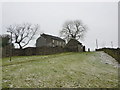
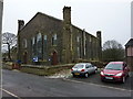
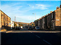
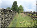
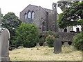
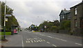
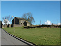
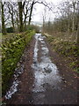

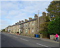
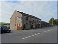
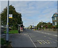
36 photos from this area
Area Information
Key information about the BB4 8BW including its size, population, and administrative classification.
- Area Type
- Postcode
- Area Size
- 9388 m²
- Population
- 2036
- Population Density
- 1116 people/km²
House Prices in BB4 8BW
39
Properties
£114,760
Average Sold Price
£13,500
Lowest Price
£455,000
Highest Price
Showing 39 properties
| Address | Type | Beds | Baths | Last Sale Price | Last Sale Date | |
|---|---|---|---|---|---|---|
| 765 Burnley Road, Crawshawbooth, Rossendale, BB4 8BW | Terraced | 3 | 1 | £202,500 | May 2025 | |
| 787 Burnley Road, Crawshawbooth, Rossendale, BB4 8BW | house | 3 | - | £125,000 | Oct 2024 | |
| 797 Burnley Road, Crawshawbooth, Rossendale, BB4 8BW | Terraced | 3 | 1 | £138,500 | Jul 2024 | |
| 807 Burnley Road, Crawshawbooth, Rossendale, BB4 8BW | Terraced | 2 | 1 | £150,000 | Aug 2023 | |
| 773 Burnley Road, Crawshawbooth, Rossendale, BB4 8BW | Terraced | 3 | 1 | £135,500 | May 2023 | |
| 809 Burnley Road, Crawshawbooth, Rossendale, BB4 8BW | Terraced | 3 | 1 | £173,000 | Aug 2022 | |
| 741 Burnley Road, Crawshawbooth, Rossendale, BB4 8BW | Terraced | 3 | 1 | £150,000 | May 2022 | |
| 739 Burnley Road, Crawshawbooth, Rossendale, BB4 8BW | Terraced | 2 | 1 | £139,500 | Mar 2021 | |
| 783 Burnley Road, Crawshawbooth, Rossendale, BB4 8BW | Semi-detached | 6 | 3 | £455,000 | Dec 2019 | |
| 781 Burnley Road, Crawshawbooth, Rossendale, BB4 8BW | Terraced | 3 | 1 | £145,000 | Mar 2019 |
Page 1 of 4
Energy Efficiency in BB4 8BW
Amenities
Schools
| Rank | School | Type | Entry gender | Ages |
|---|
Explore more schools in this area
Go to Schools tabDemographics
Household Size
Two person
most common
Accommodation Type
Houses
most common
Tenure
76
majority
Ethnic Group
White
most common
Religion
N/A
most common
Household Composition
N/A
most common
Age
47
median
Adults (30-64 years)
most common
Household Deprivation
N/A
with no deprivation
NS-SEC
38
in Lower managerial occupations
Explore more demographic insights in this area
Go to Demographics tabPlanning
Planning Constraints
- Flood RiskPremium
- Ramsar Wetland SitesPremium
- Area of Outstanding Natural BeautyPremium
- Protected Nature ReservePremium
- Protected WoodlandPremium