Area Overview for BB4 7XX
Photos of BB4 7XX
Area Information
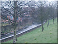
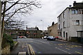
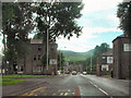
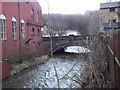
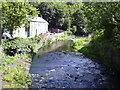
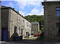
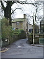
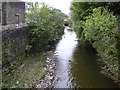
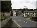
Living in BB4 7XX, a small residential cluster in the historic mill town of Waterfoot, Lancashire, offers a blend of heritage and practicality. The area, part of the Borough of Rossendale, is positioned between Rawtenstall and Bacup, with the River Irwell and Whitewell Brook shaping its geography. With a population of 2,697 and a density of 867 people per square kilometre, it is a tight-knit community rooted in industrial history. Waterfoot’s 19th-century growth as a felt-making and textile hub left a legacy of characterful architecture, including the distinctive canopied walkway of Victoria or Trickett’s Arcade, a Grade II-listed conservation area. Daily life here is shaped by proximity to local amenities, including shops, rail links, and schools. The area’s appeal lies in its manageable size, historic charm, and connectivity to nearby towns like Rawtenstall and Ramsbottom. While not a bustling urban centre, BB4 7XX offers a quieter, community-focused lifestyle, ideal for those seeking a balance between tradition and modern convenience.
- Area Type
- Postcode
- Area Size
- Not available
- Population
- 2697
- Population Density
- 867 people/km²
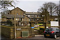
The property market in BB4 7XX is characterised by a high rate of home ownership (65%) and a predominance of houses, which is unusual for areas with higher rental activity. This suggests a community of long-term residents who have invested in property, likely reflecting the area’s historical stability and the appeal of its semi-rural setting. The focus on houses rather than flats or apartments implies larger living spaces, which may cater to families or those seeking more space. However, as a small postcode area, the housing stock is limited, and buyers may need to consider nearby towns like Rawtenstall or Bacup for additional options. The market is not heavily influenced by speculative investment, with properties likely retaining traditional values tied to the area’s industrial and historic character.
House Prices in BB4 7XX
No properties found in this postcode.
Energy Efficiency in BB4 7XX
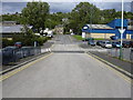
Residents of BB4 7XX enjoy a range of nearby amenities within practical reach, including retail options like Lidl Rawtenstall, Co-op Waterfoot, and Tesco Rawtenstall, which cater to everyday shopping needs. The town’s historic character is complemented by its transport links, with metro stops at Rawtenstall and Ramsbottom, and rail stations offering access to broader networks. The conservation area status of Waterfoot’s town centre adds to the area’s appeal, with its canopied walkway and preserved architecture. While the area lacks large leisure facilities, the proximity to surrounding towns provides opportunities for dining, entertainment, and outdoor activities. The blend of local shops, historic features, and transport options creates a convenient yet distinct lifestyle, ideal for those valuing accessibility without sacrificing a sense of place.
Amenities
Schools
Residents of BB4 7XX have access to two schools within practical reach: Cloughfold Primary School, a standard primary institution, and Rawtenstall Cribden House Community Special School, which caters to students with specific educational needs. The presence of both a mainstream primary and a special needs school indicates a diverse educational landscape, accommodating a range of learning requirements. While no Ofsted ratings are provided, the mix of school types suggests a commitment to inclusive education. Families with children may benefit from the proximity to these institutions, though the absence of secondary schools in the immediate area could necessitate travel to nearby towns. The schools reflect the community’s focus on accessibility and support for all students, aligning with the area’s broader emphasis on practical, local services.
| Rank | School | Type | Entry gender | Ages |
|---|
Explore more schools in this area
Go to Schools tabDemographics
The community in BB4 7XX is predominantly composed of adults aged 30-64, with a median age of 47. This suggests a mature population, likely with established careers and families. Home ownership rates are 65%, indicating a stable, long-term resident base, while the accommodation type is primarily houses, reflecting a more traditional housing stock. The predominant ethnic group is White, though no specific data on diversity or deprivation is provided. The age profile and ownership figures suggest a community focused on stability, with fewer young families or transient residents. The absence of detailed diversity metrics means broader social dynamics remain unexplored, but the demographic data points to a settled, middle-aged population with a strong connection to local heritage and infrastructure.
Household Size
Accommodation Type
Tenure
Ethnic Group
Religion
Household Composition
Age
Household Deprivation
NS-SEC
Explore more demographic insights in this area
Go to Demographics tabPlanning
Planning Constraints
- Flood RiskPremium
- Ramsar Wetland SitesPremium
- Area of Outstanding Natural BeautyPremium
- Protected Nature ReservePremium
- Protected WoodlandPremium