Area Overview for BB4 7EH
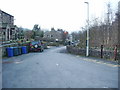
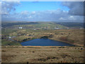
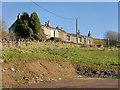
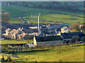
Photos of BB4 7EH
Area Information
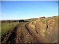
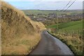
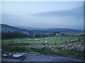
Living in BB4 7EH, part of the historic mill town of Waterfoot in Lancashire, offers a blend of small-town charm and practical connectivity. With a population of 1,219 and a density of 349 people per square kilometre, the area is a compact residential cluster nestled between Rawtenstall and Bacup. Its industrial heritage is evident in the local economy, once driven by textile manufacturing and now marked by the legacy of brands like Karrimor, which originated from a bicycle shop in the 1930s. The town’s character is defined by its conservation area status, including the distinctive canopied walkway of Victoria or Trickett’s Arcade, a 19th-century iron-and-glass structure. Daily life here is shaped by proximity to nearby towns, with Rawtenstall and Ramsbottom within easy reach, and a mix of local shops, schools, and transport links. The area’s small size means a tight-knit community, though its practical amenities and historical roots make it appealing to those seeking a balance between tradition and modern convenience.
- Area Type
- Postcode
- Area Size
- Not available
- Population
- 1219
- Population Density
- 349 people/km²
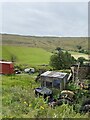
The property market in BB4 7EH is primarily owner-occupied, with 66% of homes owned by residents rather than rented. The accommodation type is predominantly houses, which is typical for small rural or semi-rural areas. This suggests a market skewed towards family homes and long-term residency rather than short-term rental properties. Given the area’s small size and low population density, the housing stock is likely limited, with buyers needing to consider nearby towns like Rawtenstall or Ramsbottom for additional options. The focus on houses may appeal to those seeking space and privacy, though the compact nature of BB4 7EH means property availability could be constrained. Buyers should also note the area’s conservation status, which may influence property values and development potential.
House Prices in BB4 7EH
No properties found in this postcode.
Energy Efficiency in BB4 7EH
Residents of BB4 7EH have access to a range of local amenities within practical reach. The area includes retail options such as Co-op Waterfoot, Spar, and Lidl Rawtenstall, offering everyday shopping needs. Nearby towns like Rawtenstall and Ramsbottom provide additional leisure and dining choices, while Rochdale Town Centre offers a broader selection of services. The area is served by Bacup and Rawtenstall Grammar School, a selective state school with a long history, alongside Waterfoot Primary and St Anne’s C of E Primary, ensuring educational options for families. The town’s historic character, including its conservation area and the canopied walkway, adds a unique aesthetic to daily life. While the immediate vicinity is modest in scale, the proximity to larger towns enhances lifestyle flexibility, balancing local charm with regional connectivity.
Amenities
Schools
| Rank | School | Type | Entry gender | Ages |
|---|
Explore more schools in this area
Go to Schools tabDemographics
The population of BB4 7EH is predominantly middle-aged, with a median age of 47 and the most common age range being adults aged 30–64. This suggests a mature, stable community with a focus on family living, reflected in the 66% home ownership rate. The area is characterised by houses rather than flats, indicating a preference for private, detached or semi-detached properties. The predominant ethnic group is White, though specific data on diversity is not provided. The age profile and ownership figures suggest a settled population with long-term residency, likely prioritising stability over transient rental markets. The absence of detailed deprivation data means quality of life is inferred from the area’s low flood risk, limited planning constraints, and access to essential services.
Household Size
Accommodation Type
Tenure
Ethnic Group
Religion
Household Composition
Age
Household Deprivation
NS-SEC
Explore more demographic insights in this area
Go to Demographics tabPlanning
Planning Constraints
- Flood RiskPremium
- Ramsar Wetland SitesPremium
- Area of Outstanding Natural BeautyPremium
- Protected Nature ReservePremium
- Protected WoodlandPremium