Area Overview for BB4 6TQ
Photos of BB4 6TQ
Area Information
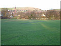
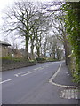
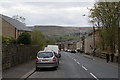
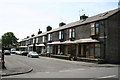
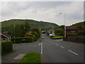
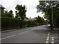
BB4 6TQ sits within the Greenfield and Eden Ward of Rossendale Borough, serving as a quiet residential cluster on the western edge of the Prescot and Rawtenstall corridor. This specific postcode covers a relatively compact footprint of 9,946 square metres, supporting a population of 1,449. The area functions primarily as a dormitory settlement for the broader Lancashire region, reflecting the post-industrial character of the wider Edenfield village it serves. Located approximately six miles from Norden, the cluster benefits from a dense residential layout that prioritises proximity over sprawl. Living in this postcode means being embedded in a community with deep historical roots, stretching back to 16th-century chapel records and 19th-century mill construction. The area has transitioned from a manufacturing hub driven by textile mills and quarrying to a peaceful residential zone. Today, the local atmosphere is defined by historic Pennine stone houses and older factory-brick developments built after the Second World War. While the village retains its rural identity, the immediate surroundings offer a structured environment for families and commuters seeking a balance between village life and access to larger towns like Rawtenstall and Ramsbottom.
- Area Type
- Postcode
- Area Size
- 9946 m²
- Population
- 1449
- Population Density
- 1064 people/km²
Homes in BB4 6TQ are overwhelmingly owner-occupied, with a striking 78% of properties held in ownership. This high rate suggests a established market where families buy to stay rather than rent for short periods. The vast majority of accommodation consists of houses, consistent with the village culture surrounding Edenfield. This housing stock typically includes the older historic Pennine stone houses and later factory-brick terraces found in the area. For buyers, this indicates a market familiar with renovation and extension projects common in older stone properties. The cluster nature of the postcode means houses are situated close together, fostering a sense of established neighbourhood standards. Although the document does not provide average sale prices or rental yields, the high ownership rate implies price stability and a lack of speculative buying. Residents are likely long-term occupants who understand the local market values. When purchasing a home in this borough, buyers should expect to find properties that reflect the area's industrial heritage mixed with modern adaptation. The focus on house ownership reinforces the idea that this is a place for those investing in their future base rather than transient living.
House Prices in BB4 6TQ
Showing 12 properties
| Address | Type | Beds | Baths | Last Sale Price | Last Sale Date | |
|---|---|---|---|---|---|---|
| 6 Conway Close, Haslingden, Rossendale, BB4 6TQ | house | - | - | £265,000 | Nov 2013 | |
| 3 Conway Close, Haslingden, Rossendale, BB4 6TQ | house | - | - | £200,000 | Jan 2013 | |
| 14 Conway Close, Haslingden, Rossendale, BB4 6TQ | Detached | 4 | 3 | £195,000 | Dec 2011 | |
| 1 Conway Close, Haslingden, Rossendale, BB4 6TQ | Detached | 4 | 2 | £202,500 | Sep 2010 | |
| 2 Conway Close, Haslingden, Rossendale, BB4 6TQ | Detached | 3 | 1 | £219,000 | Oct 2008 | |
| 16 Conway Close, Haslingden, Rossendale, BB4 6TQ | Detached | - | - | £113,000 | Jul 1999 | |
| 5 Conway Close, Haslingden, Rossendale, BB4 6TQ | Bungalow | 2 | 2 | - | - | |
| 4 Conway Close, Haslingden, Rossendale, BB4 6TQ | house | - | - | - | - | |
| 12 Conway Close, Haslingden, Rossendale, BB4 6TQ | Detached | - | - | - | - | |
| 8 Conway Close, Haslingden, Rossendale, BB4 6TQ | Detached | - | - | - | - |
Energy Efficiency in BB4 6TQ
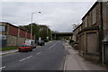
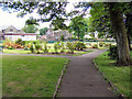
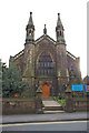
Residents of BB4 6TQ enjoy convenient access to essential retail, public transport, and rail links within practical reach. For shopping, Tesco Rossendale and Co-op Haslingden are key destinations, alongside M&S Rawtenstall. These venues cover daily grocery needs and general household requirements. Commuters benefit from two metro transport options located in Rawtenstall and Ramsbottom. Furthermore, five train stations serve the wider region, including Accrington Railway Station, Entwistle Railway Station, and Church and Oswaldtwistle Railway Station. These rail connections provide straightforward travel links to Manchester and beyond. The local area maintains its rural village character through historic landmarks like the Rostron Arms and The Coach public houses. The Edenfield Community Centre and Cricket Club serve as focal points for local social interaction and leisure. Historical elements remain visible in the form of closed mills and quarrying sites in Dearden Clough. Living here offers a blend of village convenience, with local shops and pubs, alongside the stability of being situated near major transport arteries. The area balances quiet residential life with the practical reach of regional services.
Amenities
Schools
Families living in BB4 6TQ have access to a mix of education providers within practical reach. Haslingden Broadway Primary School offers primary education and holds a good Ofsted rating. Meanwhile, Haslingden High School and Sixth Form also carries a good Ofsted rating, providing a consistent quality of education across both stages. For families with special educational needs, options include Tor View Specialist Learning Community, Valley School, and Tor View School. These special education institutions ensure that diverse learning requirements are met close to home. The presence of primary and secondary schools with good ratings suggests a supportive educational environment for children. This mix of institutions allows parents to keep their children within the immediate area as they progress from primary years through to high school. Living in this postcode means prioritising educational proximity without needing to travel far for schooling. The availability of specialist schools nearby also adds a layer of security for parents seeking specialised support for their children's development.
| Rank | School | Type | Entry gender | Ages |
|---|
Explore more schools in this area
Go to Schools tabDemographics
The community within BB4 6TQ is dominated by adults aged between 30 and 64 years. The median age for residents is exactly 47 years, indicating a neighbourhood with a significant presence of established households rather than young singles or elderly retirees. This age profile suggests a stable environment where children are common and residents are likely settled in their properties for the long term. Approximately 78% of all homes in this postcode are owned outright or with a mortgage, highlighting a strong culture of home ownership. The remaining 22% of households consist of renters, reflecting a market where ownership is clearly the norm. Almost all accommodation within this cluster comprises houses, aligning with the demographic trend towards larger family living spaces. The population is predominantly White, forming the majority of the local population. With a population density of 1,064 people per square kilometre, the area is moderately dense, ensuring neighbours are close enough to foster a community feel while maintaining individual privacy. Living here means joining a demographic slice of society that values stability and traditional family structures.
Household Size
Accommodation Type
Tenure
Ethnic Group
Religion
Household Composition
Age
Household Deprivation
NS-SEC
Explore more demographic insights in this area
Go to Demographics tabPlanning
Planning Constraints
- Flood RiskPremium
- Ramsar Wetland SitesPremium
- Area of Outstanding Natural BeautyPremium
- Protected Nature ReservePremium
- Protected WoodlandPremium