Area Overview for BB4 6JF
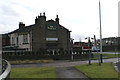
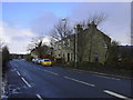
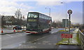
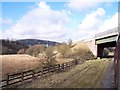
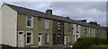
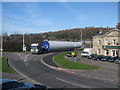
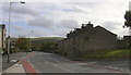
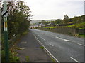
Photos of BB4 6JF
Area Information
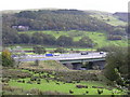
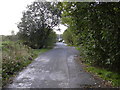
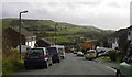
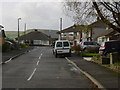
Living in BB4 6JF means inhabiting a compact, residential cluster within the Rossendale Valley, part of Longholme Ward in Lancashire. The area spans 16.9 hectares and is home to 1,238 residents, translating to a population density of 528 people per square kilometre. This small postcode area is defined by its proximity to nearby towns such as Rawtenstall and Ramsbottom, offering a blend of quiet living with accessible amenities. The demographic profile suggests a mature community, with a median age of 47 and the majority of residents falling within the 30-64 age range. Daily life here is characterised by a mix of local shops, railway stations, and nearby natural landscapes, though the area’s small size means it is best suited for those prioritising convenience over expansive space. With 80% of homes owned by residents and a focus on single-family dwellings, BB4 6JF reflects a stable, settled population. The area’s low crime risk and strong broadband connectivity further enhance its appeal for those seeking a balanced lifestyle in a well-connected, low-density setting.
- Area Type
- Postcode
- Area Size
- 16.9 hectares
- Population
- 1238
- Population Density
- 528 people/km²
The property market in BB4 6JF is dominated by owner-occupied homes, with 80% of properties owned by residents. This high home ownership rate indicates a community of long-term residents rather than a rental-driven market. The accommodation type is exclusively houses, which is uncommon in areas with higher population densities. This suggests a focus on single-family dwellings, likely appealing to those seeking privacy and space. Given the small area size of 16.9 hectares and the modest population, the housing stock is limited, making BB4 6JF a niche market for buyers prioritising residential tranquillity over investment potential. The absence of flats or apartments may limit options for first-time buyers or those seeking more affordable entry points. However, the area’s low crime risk and proximity to transport links could make it attractive for those seeking a secure, established home in a compact, well-connected postcode.
House Prices in BB4 6JF
No properties found in this postcode.
Energy Efficiency in BB4 6JF
Residents of BB4 6JF have access to a range of local amenities within practical reach. Retail options include Tesco Rossendale, Iceland Rawtenstall, and M&S Rawtenstall, providing essential shopping and dining choices. The area’s proximity to Rawtenstall and Ramsbottom metro stations enhances connectivity to larger retail and leisure hubs. While specific parks or green spaces are not detailed in the data, the absence of protected natural areas suggests the area is not defined by extensive open land. However, the presence of listed buildings in Longholme Ward hints at historical or architectural interest. The compact size of BB4 6JF means daily needs are largely met without long commutes, though the limited housing stock and small population may result in a quieter, less bustling lifestyle compared to larger towns. The combination of local shops, rail links, and a low crime risk creates a functional, low-stress environment for residents.
Amenities
Schools
| Rank | School | Type | Entry gender | Ages |
|---|
Explore more schools in this area
Go to Schools tabDemographics
The community in BB4 6JF is predominantly composed of adults aged 30-64, with a median age of 47. This suggests a population skewed towards middle-aged individuals, likely including families and professionals. Home ownership is high, with 80% of properties owned by residents, indicating a long-term presence of households rather than a transient rental market. The accommodation type is primarily houses, reflecting a preference for standalone homes over flats or apartments. The predominant ethnic group is White, though specific data on diversity is not provided. The population density of 528 people per square kilometre places this area in the lower range for urban settlements, implying a more spread-out, less congested living environment. This density, combined with the age profile, suggests a community that values stability and private space. The absence of detailed deprivation data means the quality of life can be inferred from the low crime risk and proximity to amenities, which align with a generally secure and functional residential area.
Household Size
Accommodation Type
Tenure
Ethnic Group
Religion
Household Composition
Age
Household Deprivation
NS-SEC
Explore more demographic insights in this area
Go to Demographics tabPlanning
Planning Constraints
- Flood RiskPremium
- Ramsar Wetland SitesPremium
- Area of Outstanding Natural BeautyPremium
- Protected Nature ReservePremium
- Protected WoodlandPremium