Area Overview for BB4 6DT
Photos of BB4 6DT


Area Information
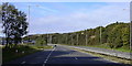
BB4 6DT is a small residential postcode cluster in Rossendale, Lancashire, with a population of 2,697 people and a density of 867 per square kilometre. It falls within Longholme Ward, part of Rossendale Borough Council, and is nestled in the Rossendale Valley. The area is characterised by its proximity to nearby towns such as Rawtenstall and Ramsbottom, offering a blend of rural and semi-urban living. With a median age of 47, the community is largely composed of adults aged 30–64, suggesting a stable, established demographic. Daily life here is shaped by the local infrastructure, including retail outlets, rail connections, and schools. The area’s compact size means residents are within practical reach of amenities, though it remains a quiet, low-density environment. Its location in the North West England provides access to larger cities like Manchester and Preston without the congestion of urban centres. For those seeking a balance between seclusion and connectivity, BB4 6DT offers a snapshot of traditional northern English living, with a focus on community and local services.
- Area Type
- Postcode
- Area Size
- Not available
- Population
- 2697
- Population Density
- 867 people/km²
BB4 6DT is predominantly a home-owning area, with 65% of properties occupied by their owners. The accommodation type is primarily houses, which is typical for smaller, rural postcode clusters. This suggests a market skewed toward residential properties rather than commercial or rental units. The low population density of 867 people per square kilometre indicates that the area is not densely built, with likely larger plots of land per property. For buyers, this means a limited selection of homes, but potentially more space per property compared to urban areas. The proximity to nearby towns like Rawtenstall and Ramsbottom may offer additional property options for those seeking more variety. However, the area’s small size means that the housing stock is finite, and buyers should consider the broader regional context when evaluating investment potential. The focus on owner-occupation also implies a stable, long-term resident base, which can be a factor in property value retention.
House Prices in BB4 6DT
Showing 1 properties
| Address | Type | Beds | Baths | Last Sale Price | Last Sale Date | |
|---|---|---|---|---|---|---|
| Tesco, Tesco Petrol Station, Bocholt Way, Rawtenstall, Rossendale, BB4 6DT | Retail | - | - | - | - |
Energy Efficiency in BB4 6DT
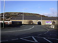
Residents of BB4 6DT have access to a range of amenities within practical reach. The area is served by five retail outlets, including Tesco, Aldi, and Iceland in Rawtenstall, offering everyday shopping needs. Nearby metro areas like Rawtenstall and Ramsbottom provide additional services, though specific leisure or recreational facilities are not detailed in the data. The rail network, with stations such as Accrington and Huncoat, connects the area to broader regional transport systems, facilitating travel to nearby cities. While the data does not mention parks or leisure spots, the presence of retail and transport options suggests a functional lifestyle focused on practicality. The compact nature of BB4 6DT means that daily errands and commuting are efficiently managed, though residents may need to travel further for more specialised amenities.
Amenities
Schools
The schools nearest to BB4 6DT include Cloughfold Primary School, which provides education for younger children, and Rawtenstall Cribden House Community Special School, catering to students with specific needs. The presence of both a primary school and a special school suggests a diverse educational landscape, though no Ofsted ratings are provided in the data. Families with children will find Cloughfold Primary School convenient for early education, while the special school offers tailored support for students requiring additional resources. However, the absence of secondary schools in the immediate area may necessitate travel to nearby towns for older students. The mix of school types reflects the community’s commitment to inclusive education, though parents should assess the suitability of these institutions for their children’s needs.
| Rank | School | Type | Entry gender | Ages |
|---|
Explore more schools in this area
Go to Schools tabDemographics
The population of BB4 6DT is 2,697, with a median age of 47, indicating a mature demographic. The most common age range is 30–64 years, reflecting a community of working-age adults and older residents. Home ownership stands at 65%, with houses being the predominant type of accommodation. This suggests a relatively stable housing market with fewer rental properties. The predominant ethnic group is White, though no further breakdown of diversity is provided. The absence of specific deprivation data means the area’s socio-economic profile remains unquantified, but the high home ownership rate and age distribution imply a settled, middle-aged population. The lack of younger residents may influence local services and amenities, which are likely tailored to older adults. The area’s compact size and low population density suggest a close-knit community, though it remains unclear whether this fosters strong social ties or isolation.
Household Size
Accommodation Type
Tenure
Ethnic Group
Religion
Household Composition
Age
Household Deprivation
NS-SEC
Explore more demographic insights in this area
Go to Demographics tabPlanning
Planning Constraints
- Flood RiskPremium
- Ramsar Wetland SitesPremium
- Area of Outstanding Natural BeautyPremium
- Protected Nature ReservePremium
- Protected WoodlandPremium