Area Overview for BB4 6BW
Photos of BB4 6BW
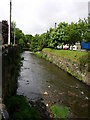
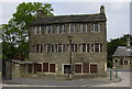
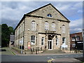
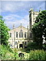
100 photos from this area
Area Information
Key information about the BB4 6BW including its size, population, and administrative classification.
- Area Type
- Postcode
- Area Size
- 6.5 hectares
- Population
- 1229
- Population Density
- 3577 people/km²
House Prices in BB4 6BW
56
Properties
£74,657
Average Sold Price
£15,300
Lowest Price
£158,000
Highest Price
Showing 56 properties
| Address | Type | Beds | Baths | Last Sale Price | Last Sale Date | |
|---|---|---|---|---|---|---|
| 72 Hardman Avenue, Rawtenstall, Rossendale, BB4 6BW | Terraced | 3 | 1 | £155,000 | Jul 2024 | |
| 110 Hardman Avenue, Rawtenstall, Rossendale, BB4 6BW | Terraced | 3 | 1 | £158,000 | Apr 2024 | |
| 94 Hardman Avenue, Rawtenstall, Rossendale, BB4 6BW | house | - | - | £100,000 | Dec 2022 | |
| 83 Hardman Avenue, Rawtenstall, Rossendale, BB4 6BW | house | 2 | - | £100,000 | May 2022 | |
| 65 Hardman Avenue, Rawtenstall, Rossendale, BB4 6BW | Terraced | 2 | 1 | £77,000 | May 2019 | |
| 120 Hardman Avenue, Rawtenstall, Rossendale, BB4 6BW | house | 2 | 1 | £92,000 | May 2017 | |
| 92 Hardman Avenue, Rawtenstall, Rossendale, BB4 6BW | house | 2 | 1 | £64,000 | Aug 2016 | |
| 104 Hardman Avenue, Rawtenstall, Rossendale, BB4 6BW | house | - | - | £65,500 | Jun 2014 | |
| 118 Hardman Avenue, Rawtenstall, Rossendale, BB4 6BW | house | 2 | - | £47,500 | Jul 2012 | |
| 71 Hardman Avenue, Rawtenstall, Rossendale, BB4 6BW | house | - | - | £60,000 | Sep 2007 |
Page 1 of 6
Energy Efficiency in BB4 6BW
Amenities
Schools
| Rank | School | Type | Entry gender | Ages |
|---|
Explore more schools in this area
Go to Schools tabDemographics
Household Size
One person
most common
Accommodation Type
Houses
most common
Tenure
39
majority
Ethnic Group
White
most common
Religion
N/A
most common
Household Composition
N/A
most common
Age
47
median
Adults (30-64 years)
most common
Household Deprivation
N/A
with no deprivation
NS-SEC
17
in Lower managerial occupations
Explore more demographic insights in this area
Go to Demographics tabPlanning
Planning Constraints
- Flood RiskPremium
- Ramsar Wetland SitesPremium
- Area of Outstanding Natural BeautyPremium
- Protected Nature ReservePremium
- Protected WoodlandPremium