Area Overview for BB4 5TU
Photos of BB4 5TU
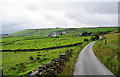
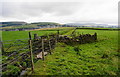
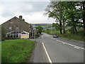
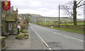
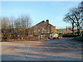
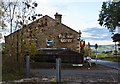
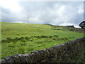
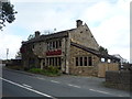
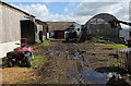
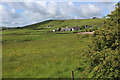
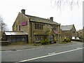
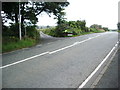
25 photos from this area
Area Information
Key information about the BB4 5TU including its size, population, and administrative classification.
- Area Type
- Postcode
- Area Size
- 79.0 hectares
- Population
- 1561
- Population Density
- 160 people/km²
House Prices in BB4 5TU
13
Properties
£316,790
Average Sold Price
£80,000
Lowest Price
£865,000
Highest Price
Showing 13 properties
| Address | Type | Beds | Baths | Last Sale Price | Last Sale Date | |
|---|---|---|---|---|---|---|
| Higher Barn Farm, Roundhill Road, Haslingden, Rossendale, BB4 5TU | Farm | 6 | - | £865,000 | Jul 2025 | |
| 309 Roundhill Road, Haslingden, Rossendale, BB4 5TU | house | 4 | 1 | £129,950 | Nov 2009 | |
| Perpetual (bolton) Limited, Higher Cockham Farm, Roundhill Road, Haslingden, Rossendale, BB4 5TU | Retirement | - | - | £380,000 | Jun 2003 | |
| Roundhill Cottage, Roundhill Road, Haslingden, Rossendale, BB4 5TU | Semi-detached | - | - | £129,000 | Nov 2001 | |
| Coldwells Farm House, Roundhill Road, Haslingden, Rossendale, BB4 5TU | Detached | - | - | £80,000 | Jan 1999 | |
| Caravan, Higher Barn Stables, Roundhill Road, Haslingden, Rossendale, BB4 5TU | Farm | - | - | - | - | |
| Roundhill Lodge, Roundhill Road, Haslingden, Rossendale, BB4 5TU | Detached | 5 | 3 | - | - | |
| 307 Roundhill Road, Haslingden, Rossendale, BB4 5TU | house | - | - | - | - | |
| Sunnyfield Slack Farm, Roundhill Road, Haslingden, Rossendale, BB4 5TU | Detached | - | - | - | - | |
| Roundhill Farm, Roundhill Road, Haslingden, Rossendale, BB4 5TU | Semi-detached | - | - | - | - |
Page 1 of 2
Energy Efficiency in BB4 5TU
Amenities
Schools
| Rank | School | Type | Entry gender | Ages |
|---|
Explore more schools in this area
Go to Schools tabDemographics
Household Size
Two person
most common
Accommodation Type
Houses
most common
Tenure
73
majority
Ethnic Group
White
most common
Religion
N/A
most common
Household Composition
N/A
most common
Age
47
median
Adults (30-64 years)
most common
Household Deprivation
N/A
with no deprivation
NS-SEC
30
in Lower managerial occupations
Explore more demographic insights in this area
Go to Demographics tabPlanning
Planning Constraints
- Flood RiskPremium
- Ramsar Wetland SitesPremium
- Area of Outstanding Natural BeautyPremium
- Protected Nature ReservePremium
- Protected WoodlandPremium