Area Overview for BB4 5SZ
Photos of BB4 5SZ
Area Information
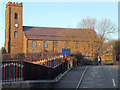
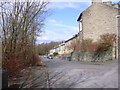
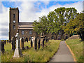
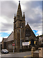
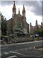
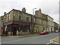
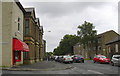
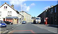
BB4 5SZ is a small residential cluster in Rossendale, Lancashire, with a population of 1,741 people spread across a compact area. Its density of 418 people per square kilometre suggests a tight-knit community, typical of historic market towns. Centred around Haslingden, the area has roots in the Forest of Rossendale, once a royal hunting ground. Today, it retains echoes of its industrial past, with textile and quarrying heritage shaping its character. The ward’s population of around 1,561 reflects its status as a local hub within Rossendale Borough. Daily life here balances proximity to retail, transport, and historical sites. Residents benefit from nearby supermarkets like Co-op Haslingden and Tesco Rossendale, while railway stations in Rawtenstall and Ramsbottom offer connections to larger cities. The area’s compact size means amenities are within practical reach, though its small footprint means it’s best suited for those prioritising community over sprawling urban sprawl.
- Area Type
- Postcode
- Area Size
- Not available
- Population
- 1741
- Population Density
- 418 people/km²
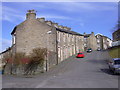
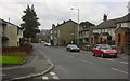
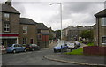
BB4 5SZ is predominantly a house-owning area, with 58% of residents owning their homes. This suggests a focus on long-term residency rather than a transient rental market. The prevalence of houses over flats indicates a traditional, family-oriented housing stock, which may appeal to buyers seeking space and privacy. Given the area’s small size, property availability is limited, and buyers may need to consider nearby postcode areas for more options. The compact nature of the cluster means properties are likely to be in close proximity to local amenities, such as the Co-op in Haslingden and railway stations in Rawtenstall. For those prioritising ownership, the area offers a stable market, though its small footprint may limit investment opportunities compared to larger towns.
House Prices in BB4 5SZ
No properties found in this postcode.
Energy Efficiency in BB4 5SZ
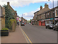
Life in BB4 5SZ is shaped by its proximity to retail, transport, and historical sites. Nearby supermarkets like Co-op Haslingden and Tesco Rossendale provide everyday essentials, while M&S Rawtenstall offers a range of goods. The area’s railway stations, including Rawtenstall and Ramsbottom, connect residents to regional hubs, enhancing access to employment, culture, and leisure. Though specific parks or recreational spaces are not detailed in the data, the town’s industrial heritage includes sites like the former Rossendale General Hospital, which may host community events. The blend of retail, transport, and historical interest creates a practical, if modest, lifestyle. For those seeking convenience without urban sprawl, BB4 5SZ offers a balance of local amenities and regional connectivity.
Amenities
Schools
| Rank | School | Type | Entry gender | Ages |
|---|
Explore more schools in this area
Go to Schools tabDemographics
The median age in BB4 5SZ is 47, with the most common age range being adults aged 30–64. This suggests a mature, stable population, likely with established careers and families. Home ownership stands at 58%, indicating a mix of owner-occupied properties and rental homes. The predominant accommodation type is houses, which aligns with the area’s residential character. The majority of residents identify as White, reflecting broader regional demographics. While no specific data on deprivation is provided, the age profile and home ownership rate suggest a community with moderate economic stability. The absence of detailed diversity statistics means the area’s cultural makeup remains less defined, but its historical roots as a market town imply a long-standing local identity.
Household Size
Accommodation Type
Tenure
Ethnic Group
Religion
Household Composition
Age
Household Deprivation
NS-SEC
Explore more demographic insights in this area
Go to Demographics tabPlanning
Planning Constraints
- Flood RiskPremium
- Ramsar Wetland SitesPremium
- Area of Outstanding Natural BeautyPremium
- Protected Nature ReservePremium
- Protected WoodlandPremium