Area Overview for BB4 5NF
Photos of BB4 5NF
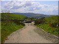
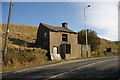
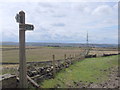

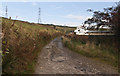
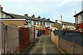
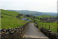
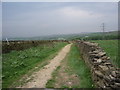
86 photos from this area
Area Information
Key information about the BB4 5NF including its size, population, and administrative classification.
- Area Type
- Postcode
- Area Size
- 7841 m²
- Population
- 1384
- Population Density
- 176512 people/km²
House Prices in BB4 5NF
25
Properties
£72,528
Average Sold Price
£16,000
Lowest Price
£112,000
Highest Price
Showing 25 properties
| Address | Type | Beds | Baths | Last Sale Price | Last Sale Date | |
|---|---|---|---|---|---|---|
| 20 Birch Avenue, Haslingden, Rossendale, BB4 5NF | Semi-detached | 3 | 1 | £80,000 | Jan 2022 | |
| 12 Birch Avenue, Haslingden, Rossendale, BB4 5NF | Semi-detached | 3 | 1 | £112,000 | Jul 2020 | |
| 14 Birch Avenue, Haslingden, Rossendale, BB4 5NF | house | - | - | £85,000 | Jul 2019 | |
| 25 Birch Avenue, Haslingden, Rossendale, BB4 5NF | Semi-detached | 2 | - | £80,000 | Nov 2013 | |
| 13 Birch Avenue, Haslingden, Rossendale, BB4 5NF | Terraced | - | - | £79,000 | Dec 2007 | |
| 27 Birch Avenue, Haslingden, Rossendale, BB4 5NF | house | - | - | £76,800 | Jul 2007 | |
| 7 Birch Avenue, Haslingden, Rossendale, BB4 5NF | Terraced | - | - | £83,000 | Apr 2007 | |
| 2 Birch Avenue, Haslingden, Rossendale, BB4 5NF | Semi-detached | - | - | £40,950 | Dec 2005 | |
| 18 Birch Avenue, Haslingden, Rossendale, BB4 5NF | house | - | - | £16,000 | Apr 1998 | |
| 4 Birch Avenue, Haslingden, Rossendale, BB4 5NF | Semi-detached | 3 | 1 | - | - |
Page 1 of 3
Energy Efficiency in BB4 5NF
Amenities
Schools
| Rank | School | Type | Entry gender | Ages |
|---|
Explore more schools in this area
Go to Schools tabDemographics
Household Size
Family (3-5 people)
most common
Accommodation Type
Houses
most common
Tenure
56
majority
Ethnic Group
White
most common
Religion
N/A
most common
Household Composition
N/A
most common
Age
47
median
Adults (30-64 years)
most common
Household Deprivation
N/A
with no deprivation
NS-SEC
22
in Lower managerial occupations
Explore more demographic insights in this area
Go to Demographics tabPlanning
Planning Constraints
- Flood RiskPremium
- Ramsar Wetland SitesPremium
- Area of Outstanding Natural BeautyPremium
- Protected Nature ReservePremium
- Protected WoodlandPremium