Area Overview for BB4 5AS
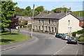
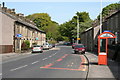
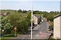
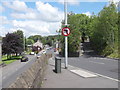
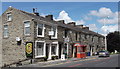
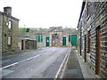
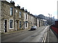
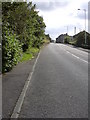
Photos of BB4 5AS
Area Information
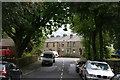
BB4 5AS is a small residential postcode area in Haslingden, Rossendale, England, with a population of 1,561 and a density of 160 people per square kilometre. This compact cluster sits within a historically significant market town, once part of the Forest of Rossendale, which was a hub of industry during the Industrial Revolution. The area’s character is shaped by its past as a wool and cotton manufacturing centre, though today it retains a quiet, community-focused vibe. Residents benefit from proximity to local amenities, including retail outlets like Co-op Haslingden and Spar, and transport links to nearby towns such as Rawtenstall and Ramsbottom. The area is served by five railway stations, including Accrington and Huncoat, offering easy access to regional networks. With a median age of 47 and a strong homeownership rate, BB4 5AS appeals to families and professionals seeking a stable, low-risk environment. Its mix of historical legacy and modern convenience makes it a distinctive choice for those prioritising safety, connectivity, and a sense of place.
- Area Type
- Postcode
- Area Size
- Not available
- Population
- 1561
- Population Density
- 160 people/km²
The property market in BB4 5AS is defined by a high rate of home ownership (73%) and a predominance of houses over flats. This suggests a community where long-term residency and family-oriented living are the norm. The small postcode area likely contains a limited number of properties, which could make the market competitive for buyers. With no indication of rental properties in the data, the area appears to be primarily owner-occupied, reducing pressure from transient tenants. The focus on houses may appeal to those seeking larger living spaces or gardens, though the compact size of the postcode means buyers should consider nearby areas for more options. The stability of the market, combined with low safety risks, positions BB4 5AS as a reliable choice for those prioritising security and a settled lifestyle.
House Prices in BB4 5AS
No properties found in this postcode.
Energy Efficiency in BB4 5AS
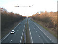
Daily life in BB4 5AS is shaped by its proximity to essential amenities and community-focused infrastructure. Residents can access retail outlets like Co-op Haslingden, Spar, and Tesco Baxenden, ensuring convenience for grocery shopping and daily errands. The area’s rail network, with stations such as Accrington and Huncoat, connects to broader regional transport systems, while nearby metro stops at Rawtenstall and Ramsbottom offer additional mobility. Though parks and leisure facilities are not explicitly detailed in the data, the historical legacy of the area—once a centre for industry and stone quarrying—may contribute to a sense of heritage and local identity. The mix of retail, transport, and historical context creates a lifestyle that balances practicality with a connection to the past, appealing to those who value accessibility and community character.
Amenities
Schools
Residents of BB4 5AS have access to two notable schools within practical reach. St John’s Stonefold CofE Primary School is a state-funded primary school with an Ofsted rating of ‘good’, offering a solid foundation for younger children. Austen House, an independent school, also holds a ‘good’ Ofsted rating, providing an alternative for families seeking private education. The presence of both state and independent options reflects the area’s appeal to a range of educational preferences. For primary-age children, the proximity of these schools reduces commuting time and supports a family-friendly environment. While no secondary schools are listed, the nearby town of Haslingden likely offers additional options. The quality of local education, combined with the area’s safety profile, makes BB4 5AS attractive for families prioritising schooling.
| Rank | School | Type | Entry gender | Ages |
|---|
Explore more schools in this area
Go to Schools tabDemographics
The population of BB4 5AS is predominantly adults aged 30–64, with a median age of 47. This suggests a mature, established community with a focus on family life and long-term residency. Homeownership is high at 73%, indicating a stable housing market where most residents own their homes. The area is characterised by a predominance of houses rather than flats, reflecting a suburban or semi-rural layout. The predominant ethnic group is White, though specific data on diversity or deprivation is not provided. The age profile implies a balance between working-age adults and retirees, with fewer younger households. This demographic structure likely supports local services and schools, as the population is neither overly youthful nor elderly. The low crime risk score of 71/100 further aligns with the area’s appeal to families seeking safety and a predictable quality of life.
Household Size
Accommodation Type
Tenure
Ethnic Group
Religion
Household Composition
Age
Household Deprivation
NS-SEC
Explore more demographic insights in this area
Go to Demographics tabPlanning
Planning Constraints
- Flood RiskPremium
- Ramsar Wetland SitesPremium
- Area of Outstanding Natural BeautyPremium
- Protected Nature ReservePremium
- Protected WoodlandPremium