Area Overview for BB4 0HH
Photos of BB4 0HH
Area Information
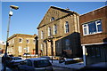
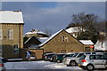
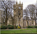
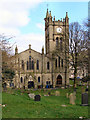
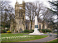
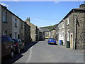
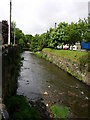
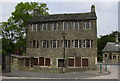
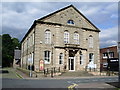
Living in BB4 0HH means being part of a tightly knit community in the historic mill town of Waterfoot, nestled between Rawtenstall and Bacup in Lancashire. With a population of 1,648 spread across a compact area, the postcode reflects a small residential cluster with a density of 1,023 people per square kilometre. This is a place shaped by its industrial past, where textile manufacturing once thrived, and where heritage meets modern living. The town’s distinctive canopied walkway, Victoria or Trickett’s Arcade, is a testament to its 19th-century commercial heritage, though much of its original retail spaces remain unused. Daily life here is grounded in local amenities, including nearby supermarkets, rail links, and schools. The area is served by five railway stations, connecting residents to surrounding towns like Accrington and Ramsbottom. While the population is predominantly White and skewed toward middle-aged adults, the community’s character is defined by its historical roots, from felt-making to the legacy of Karrimor, the bicycle bag brand founded in a local shop. BB4 0HH is not a place for those seeking anonymity; it is a small, closely connected area where familiarity with local landmarks and traditions is almost essential.
- Area Type
- Postcode
- Area Size
- Not available
- Population
- 1648
- Population Density
- 1023 people/km²
The property market in BB4 0HH is dominated by owner-occupied homes, with 75% of residents living in houses rather than flats or apartments. This suggests a housing stock that is largely traditional, with detached or semi-detached properties forming the bulk of the available stock. The small population and compact area mean the market is limited in scale, with few new developments likely to arise. For buyers, this presents a challenge: the area is unlikely to offer a wide range of properties, and competition may be fierce among existing residents looking to upgrade or downsize. The focus on houses also means that rental opportunities are scarce, as the market is not geared toward short-term lets. Prospective buyers should consider the limited scope for investment in this small area, where property values are likely to be influenced more by location and condition than by broader market trends.
House Prices in BB4 0HH
No properties found in this postcode.
Energy Efficiency in BB4 0HH
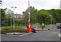
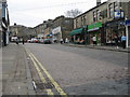
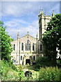
Life in BB4 0HH is shaped by its proximity to retail hubs like Lidl Rawtenstall, Asda Rawtenstall, and Tesco Rawtenstall, which provide essential shopping and dining options. The area’s historic character is complemented by modern conveniences, with nearby towns offering a broader range of services. For leisure, the town’s conservation area status ensures preserved architecture, while the nearby Bacup and Rawtenstall Grammar School and Waterfoot Primary add to the appeal for families. The B6238 and A681 roads facilitate travel to surrounding areas, and the five railway stations within practical reach connect residents to larger cities. The absence of large parks or recreational spaces is notable, but the town’s compact size means most amenities are within walking distance. This blend of historical and practical features creates a lifestyle that balances tradition with accessibility, though those prioritizing green spaces may need to look further afield.
Amenities
Schools
| Rank | School | Type | Entry gender | Ages |
|---|
Explore more schools in this area
Go to Schools tabDemographics
The residents of BB4 0HH are predominantly adults aged 30–64, with a median age of 47. This suggests a mature, settled population, likely with established careers and long-term ties to the area. Home ownership is high, at 75%, indicating a strong preference for private residences over rental properties. The accommodation type is primarily houses, reflecting a suburban or semi-rural character rather than high-density housing. The predominant ethnic group is White, with no data provided on other demographics. This age profile and ownership pattern suggest a community focused on stability and family life, though the absence of specific data on deprivation or income levels means the area’s economic challenges cannot be fully assessed. The lack of younger residents may also imply limited demand for schools or childcare facilities beyond the existing primary and grammar schools.
Household Size
Accommodation Type
Tenure
Ethnic Group
Religion
Household Composition
Age
Household Deprivation
NS-SEC
Explore more demographic insights in this area
Go to Demographics tabPlanning
Planning Constraints
- Flood RiskPremium
- Ramsar Wetland SitesPremium
- Area of Outstanding Natural BeautyPremium
- Protected Nature ReservePremium
- Protected WoodlandPremium
- Crime RiskPremium