Area Overview for BB4 0GT
Photos of BB4 0GT
Area Information
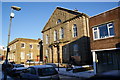
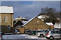
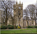
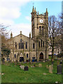
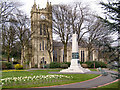
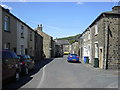
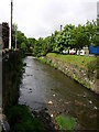
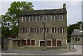
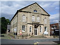
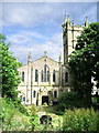
Living in BB4 0GT, a postcode covering the historic mill town of Waterfoot in Lancashire, offers a blend of industrial heritage and compact residential charm. With a population of 1,648 and a density of 1,023 people per square kilometre, this small area is tightly knit, positioned between Rawtenstall and Bacup. The town’s character is shaped by its 19th-century industrial past, particularly its role in textile manufacturing, including cotton production and felt-making. A notable legacy is Karrimor, the international brand that originated from a bicycle bag business in the 1930s. Today, the town’s centre features a distinctive canopied walkway, part of Victoria or Trickett’s Arcade, a historic retail space built by Sir Henry Whittaker Trickett. The area is designated a Town Centre Conservation Area, preserving its architectural heritage. Residents benefit from proximity to nearby towns like Rawtenstall and Ramsbottom, with essential services and transport links within reach. BB4 0GT is ideal for those seeking a quiet, historically rich community with a focus on local character and convenience.
- Area Type
- Postcode
- Area Size
- Not available
- Population
- 1648
- Population Density
- 1023 people/km²
The property market in BB4 0GT is characterised by a high rate of home ownership (75%) and a focus on houses rather than flats or apartments. This suggests a predominantly owner-occupied area with a stable, long-term resident base. Given the small size of the postcode and its designation as a conservation area, the housing stock likely includes older, characterful homes with historical features. The emphasis on houses may limit availability of rental properties, making the market more competitive for buyers seeking to purchase rather than rent. Proximity to nearby towns like Rawtenstall and Ramsbottom could offer additional options for those exploring the broader region. However, the compact nature of BB4 0GT means buyers should consider the limited local housing supply and potential for higher prices due to the area’s preserved architectural appeal.
House Prices in BB4 0GT
No properties found in this postcode.
Energy Efficiency in BB4 0GT
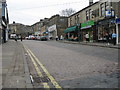
Life in BB4 0GT offers access to essential amenities within practical reach. The area is served by five retail outlets, including Lidl Rawtenstall, Asda Rawtenstall, and Tesco Rawtenstall, ensuring everyday shopping needs are met. Nearby towns like Rawtenstall and Ramsbottom provide additional retail and leisure options. Education is well-supported, with Bacup and Rawtenstall Grammar School, Waterfoot Primary, and St Anne’s C of E Primary offering schooling from early years to secondary level. The town’s historic canopied walkway adds a unique character to daily life, while the conservation area designation preserves its architectural heritage. Residents can also access rail services at nearby stations, connecting to broader networks. The combination of local shops, schools, and historical features creates a convenient, community-focused lifestyle with a strong sense of place.
Amenities
Schools
| Rank | School | Type | Entry gender | Ages |
|---|
Explore more schools in this area
Go to Schools tabDemographics
The community in BB4 0GT is predominantly middle-aged, with a median age of 47 and the most common age range being adults aged 30–64. Home ownership is high at 75%, reflecting a stable residential base, with houses being the primary accommodation type. The predominant ethnic group is White, though specific diversity statistics are not detailed. This demographic profile suggests a mature, established population with long-term ties to the area. The age range indicates a community with a mix of working-age individuals and retirees, potentially influencing local services and amenities. The high home ownership rate implies lower rental activity, which may affect property market dynamics. However, the absence of data on deprivation or income levels means quality of life factors beyond ownership and age remain unquantified.
Household Size
Accommodation Type
Tenure
Ethnic Group
Religion
Household Composition
Age
Household Deprivation
NS-SEC
Explore more demographic insights in this area
Go to Demographics tabPlanning
Planning Constraints
- Flood RiskPremium
- Ramsar Wetland SitesPremium
- Area of Outstanding Natural BeautyPremium
- Protected Nature ReservePremium
- Protected WoodlandPremium
- Crime RiskPremium