Area Overview for BB3 2TS
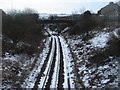
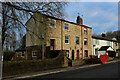
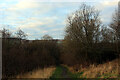
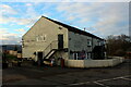
Photos of BB3 2TS
Area Information
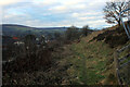
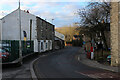
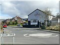
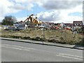
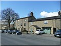
Living in BB3 2TS means being part of a tightly knit residential cluster in the historic market town of Darwen, Lancashire. The area covers just 1.9 hectares, housing 1,971 residents in a compact, densely populated space with 771 people per square kilometre. This small postcode sits within a town shaped by its industrial past, particularly its role as a hub for textile manufacturing during the Industrial Revolution. Today, BB3 2TS offers a quiet, mature community with a strong sense of local identity. The area’s proximity to historical landmarks like Darwen Jubilee Tower and India Mill adds a layer of heritage to everyday life. While the town’s economy remains rooted in its industrial legacy, residents benefit from modern amenities, including nearby supermarkets and rail links. The low crime risk and absence of environmental constraints make it an appealing choice for those seeking a stable, well-connected neighbourhood without the pressures of urban living.
- Area Type
- Postcode
- Area Size
- 1.9 hectares
- Population
- 1971
- Population Density
- 771 people/km²
The property market in BB3 2TS is dominated by owner-occupied homes, with 76% of residents living in properties they own. This contrasts with areas where rental markets dominate, indicating a community of long-term residents rather than transient tenants. The accommodation type is predominantly houses, which aligns with the area’s traditional character and the lack of high-density housing. Given the small size of the postcode (1.9 hectares), the housing stock is limited, and properties are likely to be spread across the broader Darwen area. Buyers should expect a mix of older, historically significant homes and more modern builds, though the exact range of property types is not specified. The high home ownership rate suggests a stable market, but the small area size means buyers may need to consider nearby neighbourhoods for a broader selection.
House Prices in BB3 2TS
No properties found in this postcode.
Energy Efficiency in BB3 2TS
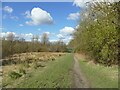
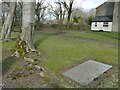
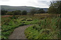
Daily life in BB3 2TS is shaped by its proximity to essential amenities and historical sites. Residents can access major supermarkets like Sainsburys Darwen, Asda Darwen, and Lidl Tockholes, ensuring convenience for grocery shopping. The area’s rail stations—Darwen, Entwistle, and Mill Hill—offer straightforward access to regional transport networks. Historically, Darwen was a textile manufacturing hub, and remnants of this heritage, such as India Mill and Darwen Jubilee Tower, add cultural depth to the community. Public access to moors and historic churches like St Peter’s Parish Church provide recreational and spiritual spaces. While the area lacks detailed information on dining or leisure venues, its compact size ensures that essential services are within easy reach, fostering a self-contained, practical lifestyle.
Amenities
Schools
| Rank | School | Type | Entry gender | Ages |
|---|
Explore more schools in this area
Go to Schools tabDemographics
The community in BB3 2TS is predominantly composed of adults aged 30–64, with a median age of 47. This suggests a mature population, likely with established careers and families. Home ownership is high, with 76% of residents owning their homes, indicating a stable, long-term demographic. The area is characterised by houses rather than flats, reflecting a preference for traditional, family-oriented housing. The predominant ethnic group is White, and no data suggests significant diversity in this postcode. The population density of 771 people per square kilometre means the area is neither sprawling nor sparse, creating a close-knit environment. While deprivation data is not provided, the high home ownership rate and absence of planning constraints suggest a relatively affluent, low-risk living environment.
Household Size
Accommodation Type
Tenure
Ethnic Group
Religion
Household Composition
Age
Household Deprivation
NS-SEC
Explore more demographic insights in this area
Go to Demographics tabPlanning
Planning Constraints
- Flood RiskPremium
- Ramsar Wetland SitesPremium
- Area of Outstanding Natural BeautyPremium
- Protected Nature ReservePremium
- Protected WoodlandPremium