Area Overview for BB2 7LZ
Photos of BB2 7LZ
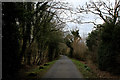
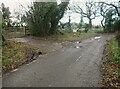
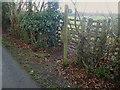
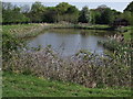
24 photos from this area
Area Information
Key information about the BB2 7LZ including its size, population, and administrative classification.
- Area Type
- Postcode
- Area Size
- 3.2 km²
- Population
- 1141
- Population Density
- 75 people/km²
House Prices in BB2 7LZ
19
Properties
£987,500
Average Sold Price
£600,000
Lowest Price
£1,375,000
Highest Price
Showing 19 properties
| Address | Type | Beds | Baths | Last Sale Price | Last Sale Date | |
|---|---|---|---|---|---|---|
| Middle Studlehurst Barn, Osbaldeston Lane, Osbaldeston, BB2 7LZ | house | - | - | £1,375,000 | Jul 2022 | |
| Mire Wood Barn, Osbaldeston Lane, Osbaldeston, BB2 7LZ | Semi-detached | 5 | 4 | £600,000 | Mar 2017 | |
| Osbaldeston Hall, Osbaldeston Lane, Osbaldeston, BB2 7LZ | Detached | 6 | 5 | - | - | |
| Turners Farm, Osbaldeston Lane, Osbaldeston, BB2 7LZ | house | 6 | 5 | - | - | |
| Higher Studlehurst Farm, Osbaldeston Lane, Osbaldeston, BB2 7LZ | Detached | 6 | 4 | - | - | |
| Former Little Oxendale Farm, Osbaldeston Lane, Osbaldeston, BB2 7LZ | Detached | - | - | - | - | |
| Annexe, New House Farm, Osbaldeston Lane, Osbaldeston, BB2 7LZ | Flat | - | - | - | - | |
| New House Barn, Osbaldeston Lane, Osbaldeston, BB2 7LZ | Detached | - | - | - | - | |
| The Lodge, Osbaldeston Lane, Osbaldeston, BB2 7LZ | Detached | - | - | - | - | |
| Tennis 46M From Burr Green Mews, Osbaldeston Lane 20M From Unnamed Road, Nightfield Lane, Balderstone, BB2 7LZ | Leisure | - | - | - | - |
Page 1 of 2
Energy Efficiency in BB2 7LZ
Amenities
Schools
| Rank | School | Type | Entry gender | Ages |
|---|
Explore more schools in this area
Go to Schools tabDemographics
Household Size
Two person
most common
Accommodation Type
Houses
most common
Tenure
81
majority
Ethnic Group
White
most common
Religion
N/A
most common
Household Composition
N/A
most common
Age
47
median
Adults (30-64 years)
most common
Household Deprivation
N/A
with no deprivation
NS-SEC
44
in Lower managerial occupations
Explore more demographic insights in this area
Go to Demographics tabPlanning
Planning Constraints
- Flood RiskPremium
- Ramsar Wetland SitesPremium
- Area of Outstanding Natural BeautyPremium
- Protected Nature ReservePremium
- Protected WoodlandPremium