Area Overview for BB2 7LF
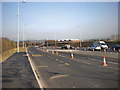
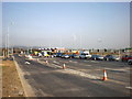
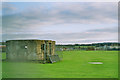
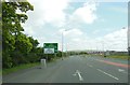
Photos of BB2 7LF

Area Information
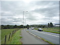
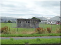
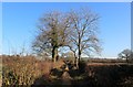
Living in BB2 7LF means settling in a small, tightly knit residential cluster in the Ribble Valley district of Lancashire. This area, covering 13.7 hectares, is home to just 1,107 people, giving it a low population density of 136 people per square kilometre. Its character is shaped by its rural setting, with the village of Balderstone at its heart. The area’s historical roots are evident in landmarks like St Leonard’s Anglican Church, dating to the reign of Henry VII, and Sunderland Hall, a modern structure with medieval monastic origins. Daily life here is quiet, with a focus on community. The village centre revolves around the church and local primary schools, while the River Ribble nearby offers a natural backdrop. BB2 7LF is ideal for those seeking a peaceful, low-density environment with easy access to nearby towns like Preston and Blackburn. Its small size means a close-knit community, where amenities are practical and local traditions are preserved.
- Area Type
- Postcode
- Area Size
- 13.7 hectares
- Population
- 1107
- Population Density
- 136 people/km²
The property market in BB2 7LF is characterised by high home ownership—86% of residents own their homes—and a predominance of houses over flats or other accommodation types. This suggests a small, stable housing stock with limited rental activity. Given the area’s compact size and low population density, the number of available properties is likely constrained, making it a niche market for buyers seeking a rural or semi-rural home. The focus on owner-occupation indicates that properties here are often long-term investments rather than short-term rentals. For buyers, this means competition may be low, but opportunities for purchase could be limited to existing homes rather than new developments. The presence of houses, rather than apartments, aligns with the area’s traditional village character, offering larger properties with potential for family living. However, the small size of BB2 7LF means buyers should consider nearby areas for additional options.
House Prices in BB2 7LF
Showing 3 properties
| Address | Type | Beds | Baths | Last Sale Price | Last Sale Date | |
|---|---|---|---|---|---|---|
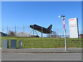
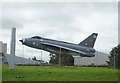
| Military Aircraft Division Samlesbury Aerodrome, Myerscough Smithy Road, Balderstone, BB2 7LF | Office | - | - | - | - | |
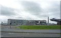
| Samlesbury Sports & Social Association, Canberra Club, Samlesbury Aerodrome, Myerscough Smithy Road, Balderstone, BB2 7LF | office_workshop | - | - | - | - | |
| Samlesbury Aerodrome, Myerscough Smithy Road, Balderstone, BB2 7LF | office_workshop | - | - | - | - |
Energy Efficiency in BB2 7LF
The lifestyle in BB2 7LF is defined by its village character and practical amenities. Nearby, five retail outlets—primarily Spar stores—offer essential shopping options, while the three railway stations provide access to regional transport. The area’s small size means amenities are concentrated, with the village centre anchored by St Leonard’s Church and the primary schools. This creates a sense of community, where daily life revolves around local landmarks and services. The River Ribble, nearby historical sites like Sunderland Hall, and the absence of major urban infrastructure contribute to a tranquil, low-density environment. While the retail options are limited to basic needs, the rail links ensure residents can access larger towns for more extensive shopping or leisure. The area’s appeal lies in its quiet, traditional setting, ideal for those prioritising convenience, safety, and a connection to rural life.
Amenities
Schools
Residents of BB2 7LF have access to two primary schools within practical reach: Balderstone St Leonard’s Church of England Voluntary Aided Primary School and Mellor St Mary Church of England Primary School. Both institutions hold an Ofsted rating of “good,” indicating a solid standard of education. The presence of two primary schools nearby offers families flexibility, with the option to choose between schools based on proximity or preference. However, the data does not mention secondary schools in the area, so families may need to consider commuting to larger towns for secondary education. The schools’ religious affiliations reflect the area’s historical and cultural context, with links to local church communities. For parents prioritising primary education, the availability of two well-rated schools is a significant advantage, supporting the area’s appeal to families seeking a stable, community-focused environment.
| Rank | School | Type | Entry gender | Ages |
|---|
Explore more schools in this area
Go to Schools tabDemographics
The demographic profile of BB2 7LF reflects a mature, stable population. The median age is 47, with the majority of residents falling within the 30-64 age range. This suggests a community of established adults, many of whom are likely to be homeowners. Home ownership is high at 86%, with houses being the predominant type of accommodation. The area is predominantly White, with no data indicating significant ethnic diversity. The low population density—136 people per square kilometre—means the area is not densely populated, contributing to a quieter, more spacious living environment. This demographic structure implies a community focused on stability and long-term residency, with fewer transient populations. The absence of specific data on deprivation or income levels means quality of life is inferred from the area’s safety, amenities, and low crime rates, which are generally positive indicators.
Household Size
Accommodation Type
Tenure
Ethnic Group
Religion
Household Composition
Age
Household Deprivation
NS-SEC
Explore more demographic insights in this area
Go to Demographics tabPlanning
Planning Constraints
- Flood RiskPremium
- Ramsar Wetland SitesPremium
- Area of Outstanding Natural BeautyPremium
- Protected Nature ReservePremium
- Protected WoodlandPremium