Area Overview for BB2 4EA
Photos of BB2 4EA

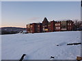
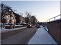
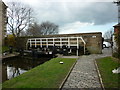
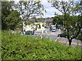
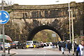
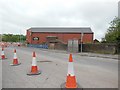
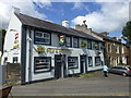
79 photos from this area
Area Information
Key information about the BB2 4EA including its size, population, and administrative classification.
- Area Type
- Postcode
- Area Size
- 7288 m²
- Population
- 1449
- Population Density
- 4728 people/km²
House Prices in BB2 4EA
31
Properties
£67,802
Average Sold Price
£15,000
Lowest Price
£132,500
Highest Price
Showing 31 properties
| Address | Type | Beds | Baths | Last Sale Price | Last Sale Date | |
|---|---|---|---|---|---|---|
| 191 St Aidans Avenue, Blackburn, BB2 4EA | Terraced | 3 | 1 | £60,000 | Dec 2025 | |
| 173 St Aidans Avenue, Blackburn, BB2 4EA | Terraced | 3 | 1 | £132,500 | Feb 2025 | |
| 174 St Aidans Avenue, Blackburn, BB2 4EA | Terraced | 3 | 1 | £120,000 | Oct 2024 | |
| 172 St Aidans Avenue, Blackburn, BB2 4EA | house | - | - | £92,000 | Jun 2024 | |
| 185 St Aidans Avenue, Blackburn, BB2 4EA | Terraced | 3 | 1 | £107,500 | Jun 2024 | |
| 179 St Aidans Avenue, Blackburn, BB2 4EA | house | - | - | £97,000 | Mar 2022 | |
| 176 St Aidans Avenue, Blackburn, BB2 4EA | Terraced | 3 | - | £50,000 | Sep 2021 | |
| 184 St Aidans Avenue, Blackburn, BB2 4EA | Terraced | 3 | 1 | £80,000 | Jul 2021 | |
| 187 St Aidans Avenue, Blackburn, BB2 4EA | house | 2 | - | £120,000 | Jun 2021 | |
| 178 St Aidans Avenue, Blackburn, BB2 4EA | house | - | - | £81,500 | Feb 2019 |
Page 1 of 4
Energy Efficiency in BB2 4EA
Amenities
Schools
| Rank | School | Type | Entry gender | Ages |
|---|
Explore more schools in this area
Go to Schools tabDemographics
Household Size
One person
most common
Accommodation Type
Houses
most common
Tenure
46
majority
Ethnic Group
White
most common
Religion
N/A
most common
Household Composition
N/A
most common
Age
47
median
Adults (30-64 years)
most common
Household Deprivation
N/A
with no deprivation
NS-SEC
17
in Lower managerial occupations
Explore more demographic insights in this area
Go to Demographics tabPlanning
Planning Constraints
- Flood RiskPremium
- Ramsar Wetland SitesPremium
- Area of Outstanding Natural BeautyPremium
- Protected Nature ReservePremium
- Protected WoodlandPremium