Area Overview for BB2 4AG
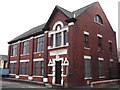
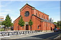
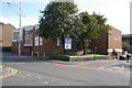
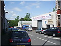
Photos of BB2 4AG
Area Information
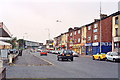
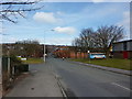
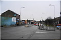
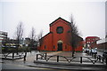
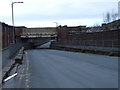
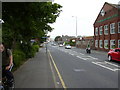
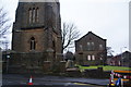
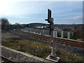
BB2 4AG is a small residential postcode in Blackburn with Darwen, Lancashire, with a population of 2175. It lies south of Blackburn town centre, near Ewood Park, the historic home of Blackburn Rovers FC since 1890. The area is defined by its proximity to the stadium, which hosts football matches and community events, and its industrial heritage, including 19th-century cotton mills along the Leeds Liverpool Canal. Daily life here is shaped by a mix of local amenities, including nearby retail hubs like Tesco Blackburn and Asda Blackburn, and accessible rail links such as Blackburn Railway Station. The community is compact, with a focus on practical living, and residents benefit from strong digital connectivity and proximity to transport networks. While the area has a distinct identity tied to its sports and industrial past, it also offers modern conveniences, making it a viable option for those seeking a balance between tradition and contemporary living.
- Area Type
- Postcode
- Area Size
- Not available
- Population
- 2175
- Population Density
- 4038 people/km²
The property market in BB2 4AG is characterised by a 40% home ownership rate, with houses being the primary accommodation type. This suggests a mix of owner-occupied homes and rental properties, though the exact proportion of the latter is unspecified. Given the small size of the postcode and its focus on houses, the housing stock is likely limited in volume, which could influence availability for buyers. The area’s proximity to Blackburn’s amenities and transport links may appeal to those seeking a semi-rural setting with urban accessibility. However, the low population density and limited data on property types mean the market is not extensively documented. Buyers should consider the area’s compact nature and its reliance on nearby infrastructure, as the immediate surroundings may offer more options for those willing to expand their search beyond BB2 4AG.
House Prices in BB2 4AG
No properties found in this postcode.
Energy Efficiency in BB2 4AG
Living in BB2 4AG offers access to a range of practical amenities within reach. Retail options include major supermarkets like Lidl Central, Tesco Blackburn, and Asda Blackburn, ensuring everyday shopping needs are met. The area’s railway stations, including Blackburn and Mill Hill, provide easy access to public transport, facilitating travel to nearby towns and cities. While the data does not specify parks or leisure facilities, the proximity to Ewood Park—a major sports venue—suggests opportunities for community events and outdoor activities. The presence of historic sites, such as the Albion Mill, adds a layer of local heritage. The compact nature of the postcode means amenities are concentrated, offering convenience for residents who prefer a walkable, accessible lifestyle without the need for long commutes.
Amenities
Schools
| Rank | School | Type | Entry gender | Ages |
|---|
Explore more schools in this area
Go to Schools tabDemographics
The population of BB2 4AG has a median age of 47, with the majority of residents aged 30–64. This suggests a community dominated by working-age adults, many of whom may be employed locally or commuting to nearby towns. Home ownership stands at 40%, indicating a mix of owner-occupied and rental properties. The predominant accommodation type is houses, which aligns with the area’s residential character. The predominant ethnic group is White, though specific data on diversity or deprivation is not provided. The age profile suggests a stable, mature population, potentially with families or professionals seeking a quieter, established neighbourhood. The lack of detailed diversity metrics means the community’s social composition remains less defined in the data, but the age range implies a focus on long-term residency rather than transient populations.
Household Size
Accommodation Type
Tenure
Ethnic Group
Religion
Household Composition
Age
Household Deprivation
NS-SEC
Explore more demographic insights in this area
Go to Demographics tabPlanning
Planning Constraints
- Flood RiskPremium
- Ramsar Wetland SitesPremium
- Area of Outstanding Natural BeautyPremium
- Protected Nature ReservePremium
- Protected WoodlandPremium