Area Overview for BB2 3YB
Photos of BB2 3YB

Area Information
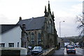
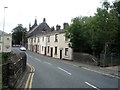
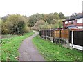
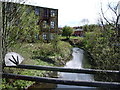
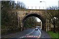
Living in BB2 3YB means being part of a small, tightly knit residential cluster in Blackburn South East, a ward within Blackburn with Darwen. The area sits on the southern edge of Blackburn, with easy access to the M65 motorway and nearby towns like Preston and Manchester. With a population of 1,734, it is a compact community centred around localities such as Fishmoor Drive and Moorgate. The area’s proximity to Blackburn town centre, Royal Blackburn Hospital, and Lower Darwen offers a blend of urban convenience and quieter suburban living. Residents benefit from multiple railway stations, including Blackburn and Mill Hill, which connect to major cities. The ward’s location near the A677 and local bus routes ensures good connectivity, while the surrounding landscape, though not designated as protected, provides a straightforward, practical environment for daily life. This is a place where families and professionals coexist, with a focus on accessibility and proximity to essential services.
- Area Type
- Postcode
- Area Size
- Not available
- Population
- 1734
- Population Density
- 4845 people/km²
The property market in BB2 3YB is shaped by its small size and the dominance of houses over other accommodation types. With 32% of homes owner-occupied, the area is not heavily skewed toward rental properties, though the relatively low home ownership rate implies a significant portion of the housing stock is rented. The presence of houses rather than flats suggests a more traditional, family-oriented housing stock, which may appeal to buyers seeking larger living spaces. However, the limited size of the area means the housing market is constrained, with limited scope for new developments. Buyers should consider the proximity to Blackburn town centre and the surrounding infrastructure, which could enhance property value. The market is likely to cater to those prioritising proximity to transport links and established residential communities over luxury or high-end features.
House Prices in BB2 3YB
No properties found in this postcode.
Energy Efficiency in BB2 3YB
Residents of BB2 3YB have access to a range of nearby amenities, including five retail venues such as M&S Blackburn Hospital, Aldi Waterloo, and Iceland Blackburn. These shops provide convenience for daily errands and grocery shopping. The area’s proximity to Blackburn town centre and Lower Darwen also offers additional retail and leisure options. Rail stations like Blackburn and Mill Hill provide easy access to public transport, while local bus routes connect to key destinations. Though the data does not specify parks or leisure facilities, the area’s practical reach includes essential services and transport hubs. The combination of retail options and transport links supports a lifestyle that balances convenience with the quietude of a suburban setting.
Amenities
Schools
The nearest school to BB2 3YB is Higher Croft Community Primary School, a primary education institution serving the local area. While no Ofsted rating is provided, the presence of a primary school within reach is a key consideration for families. The absence of secondary schools in the immediate vicinity may require residents to look further afield for secondary education, though the area’s proximity to Blackburn town centre and nearby towns could provide access to broader school options. The single primary school suggests a focused educational environment tailored to younger children, but families with older children may need to plan for commuting to larger institutions.
| Rank | School | Type | Entry gender | Ages |
|---|
Explore more schools in this area
Go to Schools tabDemographics
The population of BB2 3YB has a median age of 47, with the most common age range being adults aged 30–64. This suggests a community of established residents, many of whom may be in their prime working years or nearing retirement. Home ownership in the area stands at 32%, indicating a majority of households are renters, which could reflect the area’s mix of private and social housing. The predominant accommodation type is houses, rather than flats or apartments, which aligns with the character of a suburban residential cluster. The predominant ethnic group is White, though no specific data on diversity or deprivation levels is provided. The age profile and housing stock suggest a stable, mature population with a focus on practical living rather than high-density development.
Household Size
Accommodation Type
Tenure
Ethnic Group
Religion
Household Composition
Age
Household Deprivation
NS-SEC
Explore more demographic insights in this area
Go to Demographics tabPlanning
Planning Constraints
- Flood RiskPremium
- Ramsar Wetland SitesPremium
- Area of Outstanding Natural BeautyPremium
- Protected Nature ReservePremium
- Protected WoodlandPremium