Area Overview for BB2 3DD
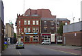
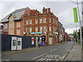
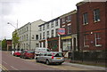
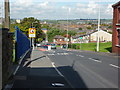
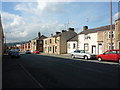
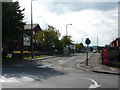
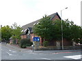
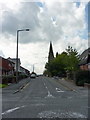
Photos of BB2 3DD
Area Information
BB2 3DD lies at the heart of Blackburn, a historic industrial town in Lancashire, just 8 miles east of Preston and 21 miles north of Manchester. This small postcode area, part of the Blackburn Central electoral ward, is a compact residential cluster with a population of 1447, centred around coordinates near Blackburn’s core. The area includes streets like Alexandra Road, Linden Avenue, and Corporation Park, blending urban convenience with pockets of green space. Blackburn’s strategic location offers easy access to major transport routes, including the M65 motorway and the A677, connecting residents to nearby cities and towns. Daily life here is shaped by its proximity to retail hubs, rail stations, and the town’s industrial heritage. While the area is small, it benefits from a mix of local amenities and connectivity, making it a practical choice for those seeking a balance between town living and regional access. The presence of schools, shops, and transport links ensures residents can meet daily needs without venturing far.
- Area Type
- Postcode
- Area Size
- Not available
- Population
- 1447
- Population Density
- 4355 people/km²
The property market in BB2 3DD is characterised by a low home ownership rate of 19%, suggesting that the area is primarily a rental market rather than one dominated by owner-occupied homes. The accommodation type is predominantly houses, which may reflect a mix of older, established properties typical of Blackburn’s industrial past. Given the small population and limited data, the housing stock is likely modest in scale, with fewer new developments. Buyers seeking owner-occupied properties may find limited options here, though the presence of houses could appeal to those preferring single-family homes. The area’s proximity to transport links and retail amenities may make it attractive for investors or renters prioritising convenience over long-term ownership. However, the low ownership rate and compact size mean the market is unlikely to cater to large-scale property buyers or those seeking extensive land.
House Prices in BB2 3DD
No properties found in this postcode.
Energy Efficiency in BB2 3DD
Residents of BB2 3DD have access to a range of nearby amenities, including five retail outlets such as Asda Blackburn, Morrisons Blackburn, and Farmfoods Blackburn, ensuring daily shopping needs are met. The area’s rail network, with stations like Blackburn and Cherry Tree, connects to broader transport systems, facilitating travel to work or leisure. While the data does not specify parks or recreational spaces, the mention of Corporation Park and Playing Field in the area’s description suggests some green space for relaxation. The compact nature of the postcode means amenities are within practical reach, though the limited variety of venues implies a focus on essentials rather than extensive leisure options. The presence of retail and transport hubs contributes to a functional lifestyle, prioritising convenience over sprawling entertainment choices.
Amenities
Schools
The nearest school to BB2 3DD is St Mary’s and St Joseph’s Roman Catholic Primary School Blackburn, a primary school with a ‘good’ Ofsted rating. This institution serves the local community, offering education for younger children within walking distance for many residents. The absence of secondary schools in the data suggests families may need to look beyond the immediate area for secondary education, though the primary school’s strong rating provides a solid foundation for early learning. The single school listed indicates a focus on primary education, which could be a consideration for families with older children. While the school’s quality is assured, the lack of information on other educational institutions means further research would be needed for comprehensive planning.
| Rank | School | Type | Entry gender | Ages |
|---|
Explore more schools in this area
Go to Schools tabDemographics
The population of BB2 3DD is 1447, with a median age of 47, indicating a community skewed toward middle-aged adults. The most common age range is 30–64 years, suggesting a stable demographic profile with fewer young families or retirees. Home ownership rates are low at 19%, meaning the majority of residents are likely renters, which may reflect the area’s character as a rental-focused zone. The predominant accommodation type is houses, though the small population and low ownership suggest limited housing stock. The predominant ethnic group is White, with no specific data on other demographics provided. This homogeneity may influence the social fabric of the area, though the absence of detailed diversity metrics means broader community composition remains unclear. The low home ownership rate could indicate challenges in property affordability or a transient population, impacting long-term stability.
Household Size
Accommodation Type
Tenure
Ethnic Group
Religion
Household Composition
Age
Household Deprivation
NS-SEC
Explore more demographic insights in this area
Go to Demographics tabPlanning
Planning Constraints
- Flood RiskPremium
- Ramsar Wetland SitesPremium
- Area of Outstanding Natural BeautyPremium
- Protected Nature ReservePremium
- Protected WoodlandPremium