Area Overview for BB18 6DT
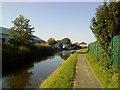
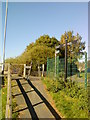
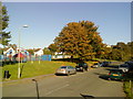
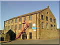
Photos of BB18 6DT
Area Information
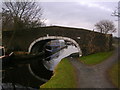
Living in BB18 6DT means being part of a small, tightly knit residential cluster in the heart of Lancashire. With a population of just 1,577, this area retains a quiet, village-like character despite its proximity to modern infrastructure. Historically rooted in Anglo-Saxon settlements and 19th-century industrial growth, BB18 6DT sits within Barnoldswick, a town shaped by the Leeds and Liverpool Canal and railway networks. Today, the area balances its heritage with contemporary living, offering residents access to nearby towns like Colne and Nelson, which provide additional services and cultural amenities. The community is defined by its modest scale, with homes predominantly in private ownership and a median age of 47 suggesting a mature demographic. Daily life here is low-key, with local amenities and rail links providing practical connectivity. For those seeking a peaceful, self-contained environment with historical depth, BB18 6DT offers a distinctive blend of tradition and accessibility.
- Area Type
- Postcode
- Area Size
- Not available
- Population
- Not available
- Population Density
- Not available
BB18 6DT is a small area with a housing stock dominated by private homes, reflecting a 53% home ownership rate. This suggests that the area is not heavily reliant on rental properties, though the remaining 47% of residents live in rented accommodation. The prevalence of houses over flats indicates a more traditional, low-density development pattern, typical of small towns and villages. Given the area’s size, the property market is likely limited in scope, with buyers needing to consider nearby postcodes for more options. The modest population and historical character of Barnoldswick may appeal to those seeking a quieter, stable environment, though the lack of high-rise or modern developments means the housing stock is unlikely to cater to younger, transient demographics. For those prioritising ownership, the area offers a sense of permanence, but the small scale means competition for properties could be limited.
House Prices in BB18 6DT
No properties found in this postcode.
Energy Efficiency in BB18 6DT
Residents of BB18 6DT have access to a range of local amenities within practical reach. The area includes five retail outlets, such as Co-op Barnoldswick, Spar, and Aldi Barnoldswick, providing essential shopping options for daily needs. These stores cater to a small community, offering convenience without the hustle of larger retail centres. The nearby rail stations—Colne, Gargrave, and Nelson—enhance mobility, allowing residents to access broader services, dining, and leisure opportunities in surrounding towns. While the area itself is compact, its proximity to Barnoldswick and nearby towns ensures that residents can enjoy a mix of local charm and regional amenities. The presence of shops and rail links contributes to a practical lifestyle, balancing self-sufficiency with the flexibility to explore beyond the immediate vicinity.
Amenities
Schools
The nearest school to BB18 6DT is Rainhall Road Community Primary School, a primary education institution serving the local area. No specific Ofsted rating is provided in the data, but the presence of a primary school suggests that families with young children have access to essential educational infrastructure. However, the absence of secondary schools or further education facilities within the area means parents may need to look to nearby towns like Colne or Nelson for comprehensive schooling. This could be a consideration for families planning long-term residency, as the proximity to secondary education is often a key factor in property decisions. The single primary school available reflects the area’s small size and may indicate a community focused on local, community-based learning rather than large-scale institutions.
| Rank | School | Type | Entry gender | Ages |
|---|
Explore more schools in this area
Go to Schools tabDemographics
The population of BB18 6DT is 1,577, with a median age of 47 and the majority of residents falling within the 30-64 age range. This suggests a community skewed toward middle-aged adults, likely including families and professionals. Home ownership stands at 53%, with the remaining 47% living in rental properties, indicating a mixed housing market. The area is predominantly composed of houses rather than flats, reflecting a suburban or semi-rural character. The predominant ethnic group is White, though no specific data on diversity or deprivation is provided. The age profile implies a stable, established community with fewer young families or retirees compared to other areas. For buyers, this demographic suggests a focus on long-term residency and a potential demand for family-friendly housing, though the limited data on diversity means further research would be needed to assess broader social dynamics.
Household Size
Accommodation Type
Tenure
Ethnic Group
Religion
Household Composition
Age
Household Deprivation
NS-SEC
Explore more demographic insights in this area
Go to Demographics tabPlanning
Planning Constraints
- Flood RiskPremium
- Ramsar Wetland SitesPremium
- Area of Outstanding Natural BeautyPremium
- Protected Nature ReservePremium
- Protected WoodlandPremium