Area Overview for BB18 5QQ
Photos of BB18 5QQ
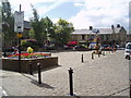
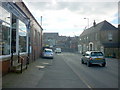
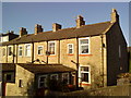
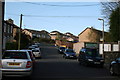
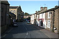
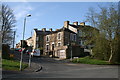
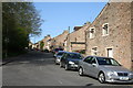
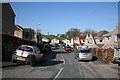
100 photos from this area
Area Information
Key information about the BB18 5QQ including its size, population, and administrative classification.
- Area Type
- Postcode
- Area Size
- 9.8 hectares
- Population
- 1269
- Population Density
- 78 people/km²
House Prices in BB18 5QQ
22
Properties
£158,303
Average Sold Price
£5,000
Lowest Price
£337,000
Highest Price
Showing 22 properties
| Address | Type | Beds | Baths | Last Sale Price | Last Sale Date | |
|---|---|---|---|---|---|---|
| 48 Esp Lane, Barnoldswick, BB18 5QQ | Terraced | 2 | 1 | £155,000 | Nov 2024 | |
| 72 Esp Lane, Barnoldswick, BB18 5QQ | Terraced | 2 | 1 | £132,000 | Aug 2024 | |
| 70 Esp Lane, Barnoldswick, BB18 5QQ | house | - | - | £283,000 | Apr 2024 | |
| 52 Esp Lane, Barnoldswick, BB18 5QQ | Cottage | 2 | 1 | £327,500 | Dec 2023 | |
| 50 Esp Lane, Barnoldswick, BB18 5QQ | house | - | - | £162,500 | Apr 2020 | |
| 60 Esp Lane, Barnoldswick, BB18 5QQ | house | - | - | £139,000 | Sep 2019 | |
| Pickles Hippins, Esp Lane, Barnoldswick, BB18 5QQ | Bungalow | - | - | £5,000 | Sep 2016 | |
| 64A Esp Lane, Barnoldswick, BB18 5QQ | Detached | - | - | £98,000 | Aug 2016 | |
| 74 Esp Lane, Barnoldswick, BB18 5QQ | house | - | - | £117,000 | Mar 2016 | |
| Springs Croft, Esp Lane, Barnoldswick, BB18 5QQ | Bungalow | 3 | 2 | £337,000 | Mar 2016 |
Page 1 of 3
Energy Efficiency in BB18 5QQ
Amenities
Schools
| Rank | School | Type | Entry gender | Ages |
|---|
Explore more schools in this area
Go to Schools tabDemographics
Household Size
Two person
most common
Accommodation Type
Houses
most common
Tenure
86
majority
Ethnic Group
White
most common
Religion
N/A
most common
Household Composition
N/A
most common
Age
47
median
Adults (30-64 years)
most common
Household Deprivation
N/A
with no deprivation
NS-SEC
32
in Lower managerial occupations
Explore more demographic insights in this area
Go to Demographics tabPlanning
Planning Constraints
- Flood RiskPremium
- Ramsar Wetland SitesPremium
- Area of Outstanding Natural BeautyPremium
- Protected Nature ReservePremium
- Protected WoodlandPremium