Area Overview for BB18 5HD
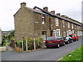
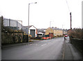
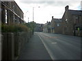
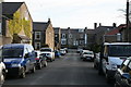
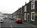
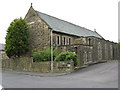
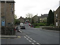
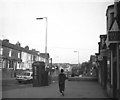
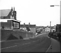
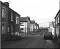
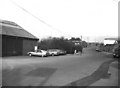
Photos of BB18 5HD

Area Information
Living in BB18 5HD means residing in a specific residential cluster located within the historic town of Barnoldswick in Lancashire. This postcode covers an area of just under an acre and is home to 1,369 people. The location sits at coordinates 53.915132, -2.186324, placing it firmly in the Borough of Pendle. You will be part of a community with deep historical roots, tracing back to the Anglo-Saxon settlement of *Bernulfeswic* mentioned in the Domesday Book of 1086. While the broader context of Barnoldswick includes a population of approximately 1,525, this area maintains its own distinct identity as a small-scale housing environment. Daily life here is shaped by proximity to the town's industrial heritage, including notable landmarks like Bancroft Mill and the Church of St Mary-le-Gill. The area offers a quiet residential setting for those who prefer a small footprint over urban sprawl. Residents benefit from the town's evolution from a woollen and cotton hub into a modern community. You are stepping into an area where history meets contemporary living, defined by its compact size and strong connection to the wider Pendle borough.
- Area Type
- Postcode
- Area Size
- 1454 m²
- Population
- 1369
- Population Density
- 9294 people/km²
The property market in BB18 5HD is characterised by a strong prevalence of owner-occupied homes. With 63% of residents owning their homes, this is clearly an area where people buy to stay rather than rent or flip. Houses are the primary form of accommodation, meaning you are unlikely to find flats or purpose-built apartments within this specific postcode. The small area size of 1,454 square metres limits the housing stock, resulting in a scarcity of properties for any given street. This scarcity often drives competition in the local market despite the modest population of 1,369. Buyers looking for a quick transaction may face longer listing cycles due to the limited supply of houses. The high home ownership rate suggests that sale prices are supported by local equity rather than rental yields. Investors should note that the lack of rental stock may constrain short-term let opportunities. Instead, the market caters to families and couples seeking a traditional house in a defined residential cluster. This dynamic creates a stable environment but fewer choices when searching for homes in BB18 5HD.
House Prices in BB18 5HD
Showing 5 properties
| Address | Type | Beds | Baths | Last Sale Price | Last Sale Date | |
|---|---|---|---|---|---|---|
| 5, Dam Side, Gisburn Street, Barnoldswick, BB18 5HD | Terraced | 1 | 1 | £116,500 | Feb 2025 | |
| 4, Dam Side, Gisburn Street, Barnoldswick, BB18 5HD | house | - | - | £90,000 | Oct 2018 | |
| 3, Dam Side, Gisburn Street, Barnoldswick, BB18 5HD | house | 2 | - | £97,000 | Dec 2017 | |
| 2, Dam Side, Gisburn Street, Barnoldswick, BB18 5HD | house | - | - | £114,000 | Feb 2017 | |
| 1, Dam Side, Gisburn Street, Barnoldswick, BB18 5HD | Terraced | - | - | - | - |
Energy Efficiency in BB18 5HD
Daily life in BB18 5HD is centred around the amenities available within practical reach of the residential cluster. Residents can access five key retail outlets, including Aldi Barnoldswick, Co-op Barnoldswick, and Spar, ensuring all essential shopping needs are met without travelling far. For travel, three railway stations serve the area: Colne Railway Station, Gargrave Railway Station, and Nelson Railway Station. These transport hubs provide the primary link to broader regions beyond Pendle. The nearby amenities create a convenient lifestyle characterised by limited travel distances for groceries and daily errands. You will find your weekly shop easily accessible alongside local banking and services found at the co-operative locations. The proximity of rail stations means you can combine local living with regional access when necessary. This blend of local convenience and transport links defines the practical day-to-day experience for everyone living in this postcode. The area supports a self-sufficient lifestyle while maintaining connectivity to wider job markets through the nearby transport network.
Amenities
Schools
| Rank | School | Type | Entry gender | Ages |
|---|
Explore more schools in this area
Go to Schools tabDemographics
You will join a community where the median age is 47 years, indicating a neighbourhood primarily populated by established adults. The most common age range falls between 30 and 64 years old, suggesting a population of families rather than young professionals or retirees. Home ownership stands at 63%, meaning nearly two out of every three residents own their property outright or with a mortgage. Houses dominate the accommodation type, reflecting a preference for detached or semi-detached living over flats. The predominant ethnic group is White, mirroring the traditional demographic composition of rural Lancashire. While no specific deprivation data is provided, the high level of home ownership and the age profile suggest a relatively stable, settled population. This demographic structure implies a community with deep local roots and long-term residents. The lack of a large young adult cohort suggests lower pressure on holiday rentals or transient populations. Families with children will find the age distribution relevant for school attendance patterns within the immediate vicinity. Property values are likely influenced by this steady, owner-occupied base rather than speculative investment trends.
Household Size
Accommodation Type
Tenure
Ethnic Group
Religion
Household Composition
Age
Household Deprivation
NS-SEC
Explore more demographic insights in this area
Go to Demographics tabPlanning
Planning Constraints
- Flood RiskPremium
- Ramsar Wetland SitesPremium
- Area of Outstanding Natural BeautyPremium
- Protected Nature ReservePremium
- Protected WoodlandPremium