Area Overview for BB12 9EH
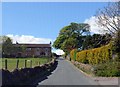
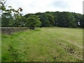
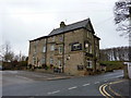
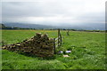
Photos of BB12 9EH
Area Information
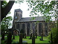
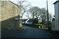
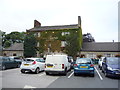
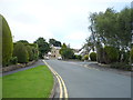
Living in BB12 9EH means being part of a small, tightly knit residential cluster in the heart of England’s Lancashire region. This postcode area spans 2.2 hectares, home to 1,585 residents, giving it a population density of 396 people per square kilometre. Its compact size reflects a rural yet accessible setting, historically rooted in Old Laund Booth, a civil parish near the River Henburn and the Leeds and Liverpool Canal. The area is 3 miles north of Burnley, offering proximity to urban amenities while retaining a quiet, community-focused character. Daily life here is shaped by its modest scale, with residents likely to know their neighbours and rely on local services. The presence of 17 listed buildings, including the 16th-century Old Laund Hall, hints at a heritage that blends medieval history with modern living. For those seeking a balance between tradition and practicality, BB12 9EH offers a distinct identity, where historical significance meets contemporary needs.
- Area Type
- Postcode
- Area Size
- 2.2 hectares
- Population
- 1585
- Population Density
- 396 people/km²
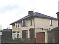
The property market in BB12 9EH is characterised by a high rate of home ownership—82% of residents live in their own homes. This suggests a strong preference for private ownership over renting, which is uncommon in many urban areas. The accommodation type is predominantly houses, indicating a lack of high-density housing such as flats or apartments. This makes the area appealing to families or individuals seeking space and privacy, though it also means the housing stock is limited in variety. Given the small size of the postcode area, the market is likely to be niche, with properties concentrated in a compact cluster. Buyers should consider that the area’s proximity to Burnley and its transport links may influence property values, but the limited scale of BB12 9EH means opportunities for expansion or development are constrained. For those prioritising ownership and traditional housing, this area offers a straightforward, stable option.
House Prices in BB12 9EH
Showing 13 properties
| Address | Type | Beds | Baths | Last Sale Price | Last Sale Date | |
|---|---|---|---|---|---|---|
| 6 Woodbury Avenue, Fence, BB12 9EH | Bungalow | 3 | 1 | £340,000 | Jun 2023 | |
| 9 Woodbury Avenue, Fence, BB12 9EH | house | - | - | £346,050 | Mar 2017 | |
| 7 Woodbury Avenue, Fence, BB12 9EH | Bungalow | 3 | - | £241,755 | Oct 2014 | |
| 14 Woodbury Avenue, Fence, BB12 9EH | Bungalow | - | - | £230,000 | Jul 2014 | |
| 12 Woodbury Avenue, Fence, BB12 9EH | Bungalow | 3 | 1 | £270,000 | Mar 2014 | |
| 22 Woodbury Avenue, Fence, BB12 9EH | Detached | - | - | £295,000 | Oct 2007 | |
| 20 Woodbury Avenue, Fence, BB12 9EH | Detached | - | - | £235,000 | Jan 2004 | |
| 16 Woodbury Avenue, Fence, BB12 9EH | Detached | 4 | 1 | - | - | |
| 8 Woodbury Avenue, Fence, BB12 9EH | Terraced | 3 | - | - | - | |
| 10 Woodbury Avenue, Fence, BB12 9EH | Detached | - | - | - | - |
Energy Efficiency in BB12 9EH
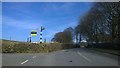
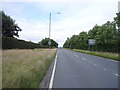
The lifestyle in BB12 9EH is shaped by its proximity to practical amenities and a quiet, community-focused environment. Residents can access essential retail services at Morrisons Daily, Asda Hollin, and Spar Nelson, making daily shopping convenient without the need for long commutes. The area’s rail connections, including Brierfield, Nelson, and Burnley Central stations, provide access to broader transport networks, facilitating travel to nearby towns for work, leisure, or socialising. While there are no explicit mentions of parks or leisure facilities in the data, the historical presence of the River Henburn and the Leeds and Liverpool Canal suggests potential for outdoor activities. The compact nature of the area means that amenities are within practical reach, supporting a lifestyle that balances local convenience with the option to explore larger urban centres.
Amenities
Schools
Residents of BB12 9EH have access to two primary schools within practical reach: Wheatley Lane Methodist Voluntary Aided Primary School and Wheatley Lane Methodist Primary School. Both institutions serve the local community, providing education for younger children. While no Ofsted ratings are provided, the presence of two primary schools suggests a focus on early education, which is crucial for families with young children. The absence of secondary schools or further education facilities in the immediate area means students may need to travel to nearby towns for higher-level education. This could be a consideration for parents planning long-term stays, as it affects the convenience of schooling. However, the availability of primary education within walking or short driving distance supports the area’s appeal for families seeking a settled, community-oriented environment.
| Rank | School | Type | Entry gender | Ages |
|---|
Explore more schools in this area
Go to Schools tabDemographics
The community in BB12 9EH is predominantly composed of adults aged 30–64, with a median age of 47. This suggests a mature population, likely with established careers and families. Home ownership is high, at 82%, indicating a stable housing market where most residents live in their own homes rather than renting. The accommodation type is largely houses, reflecting a preference for single-family dwellings over flats or apartments. The predominant ethnic group is White, aligning with broader trends in the region. The population density of 396 people per square kilometre suggests a low-rise, spread-out settlement pattern, typical of rural or semi-rural areas. While no specific deprivation data is provided, the high home ownership rate and age profile imply a community with relatively stable economic conditions, though the absence of younger demographics may affect local services and amenities tailored to children or students.
Household Size
Accommodation Type
Tenure
Ethnic Group
Religion
Household Composition
Age
Household Deprivation
NS-SEC
Explore more demographic insights in this area
Go to Demographics tabPlanning
Planning Constraints
- Flood RiskPremium
- Ramsar Wetland SitesPremium
- Area of Outstanding Natural BeautyPremium
- Protected Nature ReservePremium
- Protected WoodlandPremium